*
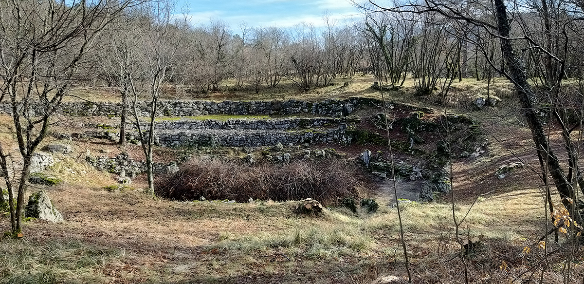
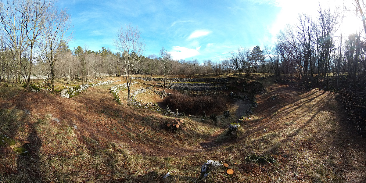
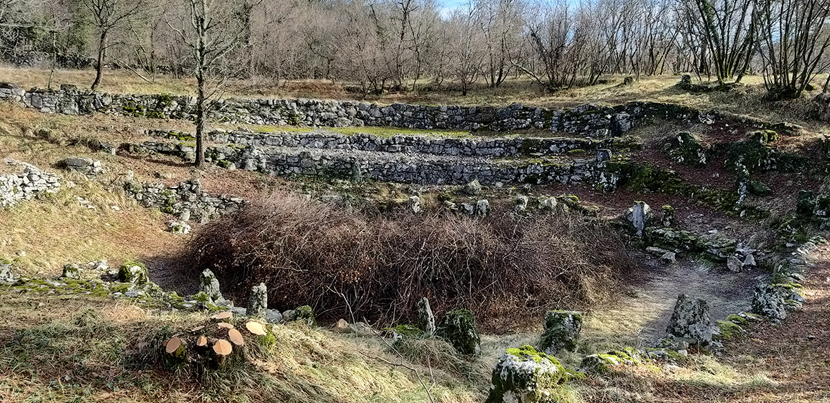
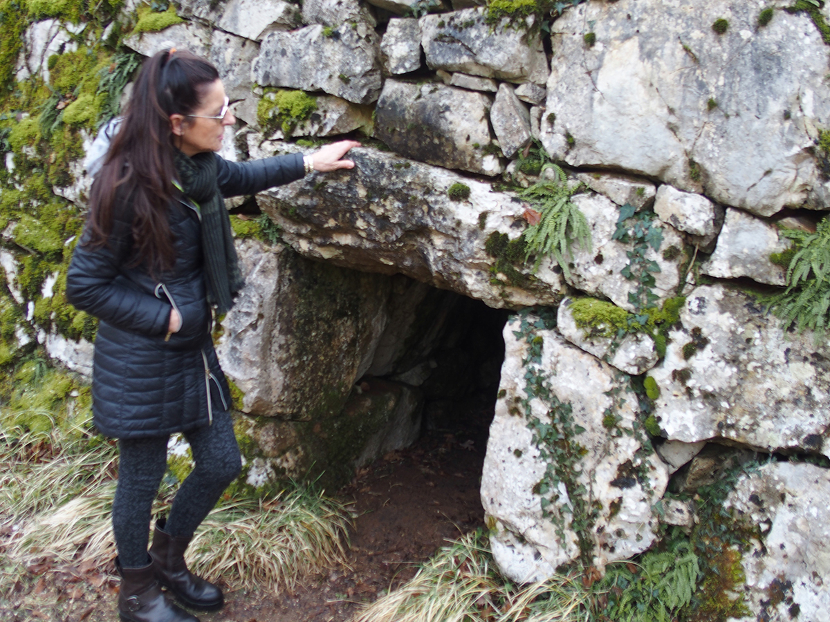
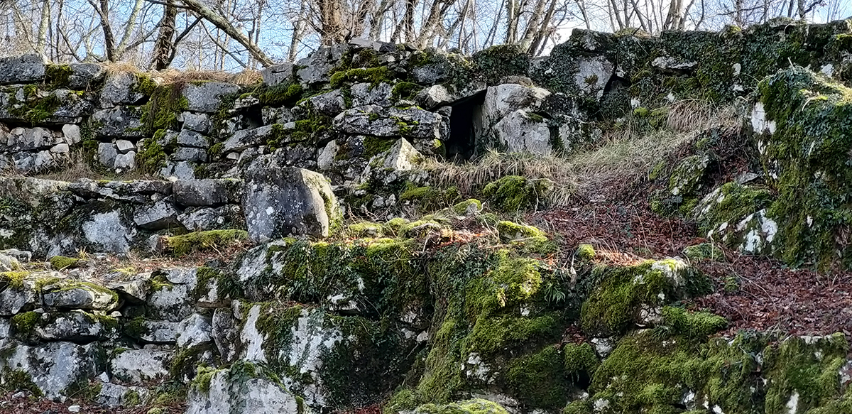
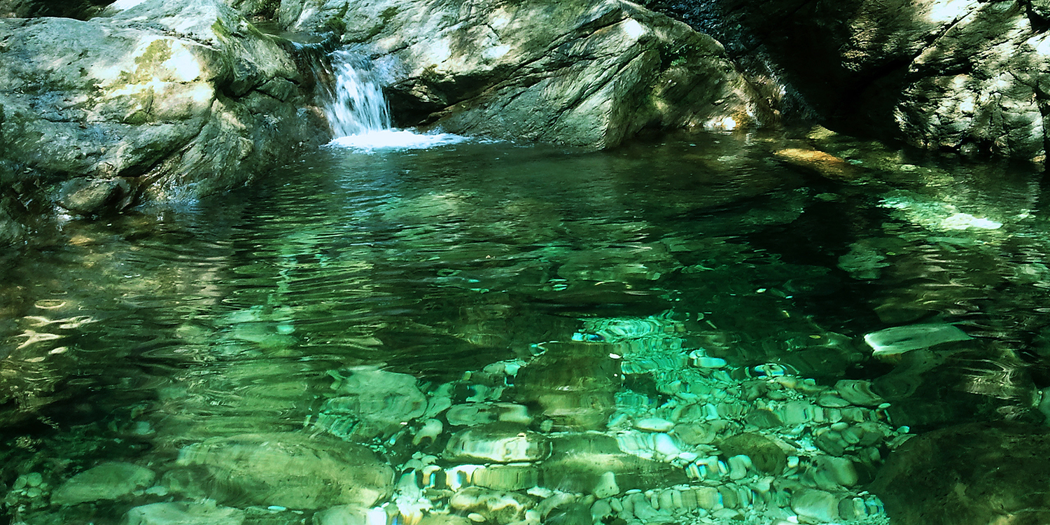
LA DOLINA DI BUGOMILI – Basovizza (TS)
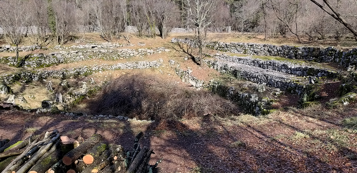
La dolina di Bugomili caratterizzata dai gradoni in pietra a secco
La dolina di sprofondamento di Bugomili è di origine carsica.
Le doline carsiche sono conche chiuse e diventano bacini che si riempiono d’acqua, originando un laghetto, se le pareti ed il fondo sono impermeabilizzati.
Di solito, invece, l’acqua viene assorbita attraverso vie sotterranee che, però, solo di rado si aprono in superficie come cavità ben rilevabili e accessibili all’uomo.
Una piccola dolina, ai confini con la Slovenia, si è trasformata in un laghetto
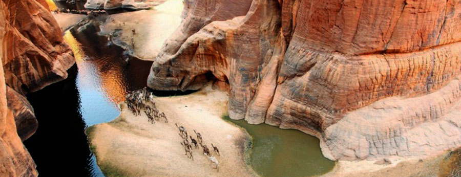
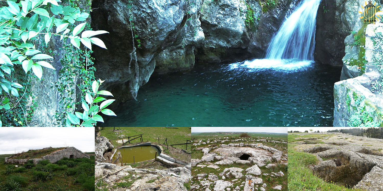
Le doline di sprofondamento delle Murge lucane e pugliesi, offrono la matrice naturale di base su cui si modellano le strutture agropastorali dei recinti e delle corti a pozzo.
Nel caso delle Murge le doline, localmente chiamate puli, sono simili a grandi imbuti, raccolgono acqua e mantengono fertile il terreno dove si sviluppa una rigogliosa vegetazione.
Una dolina di sprofondamento in Puglia nella gravina di Ginosa
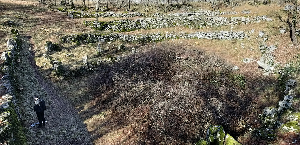
La dolina naturale di Bugomili è stata lavorata dall’uomo e si è trasformata in una sorte di anfiteatro a gradoni in pietra a secco (nel teatro greco era definita “cavea”).
*
*
*
Ha uno spazio centrale libero (nel teatro greco “orchestra) ed una camera ipogea in pietra interrata.
L’ipogeo ricorda i tholos micenei con il tipico corridoio che conduce alla camera interna di forma circolare con copertura a semicupola interamente in pietra.
E’ stato costruito di fronte all’anfiteatro come una sorta di proscenio.
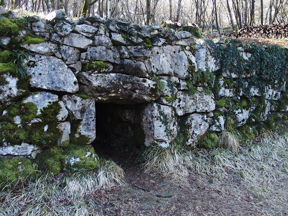
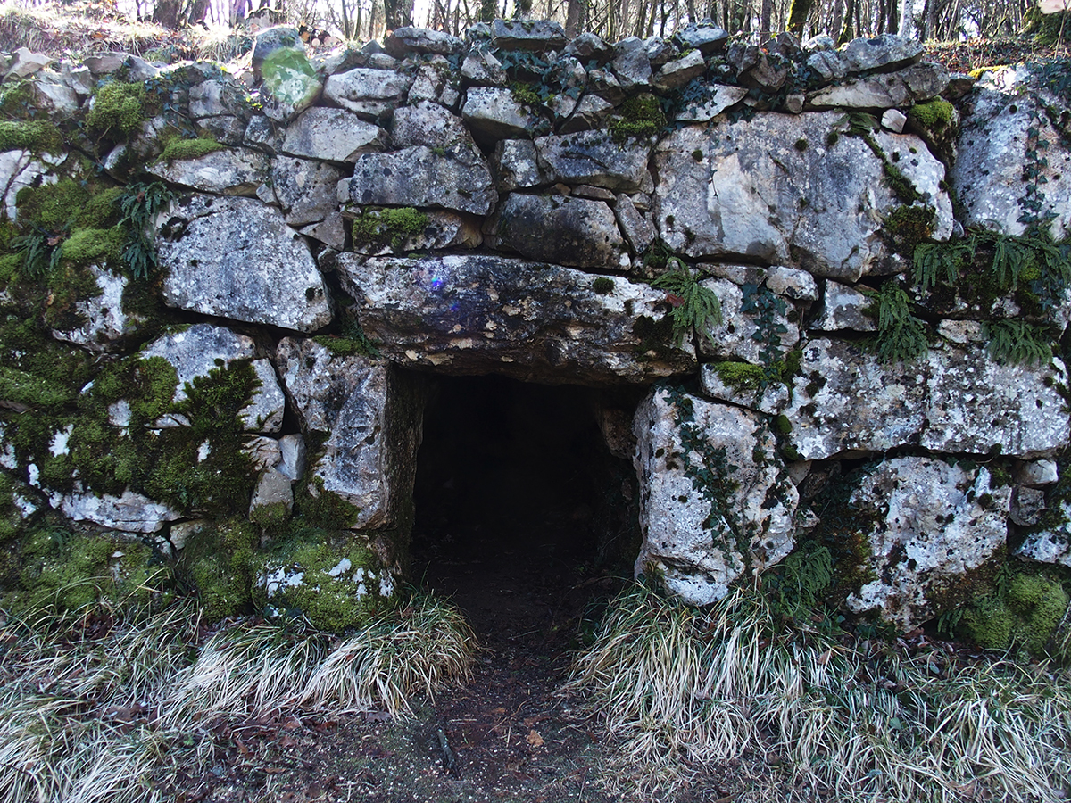
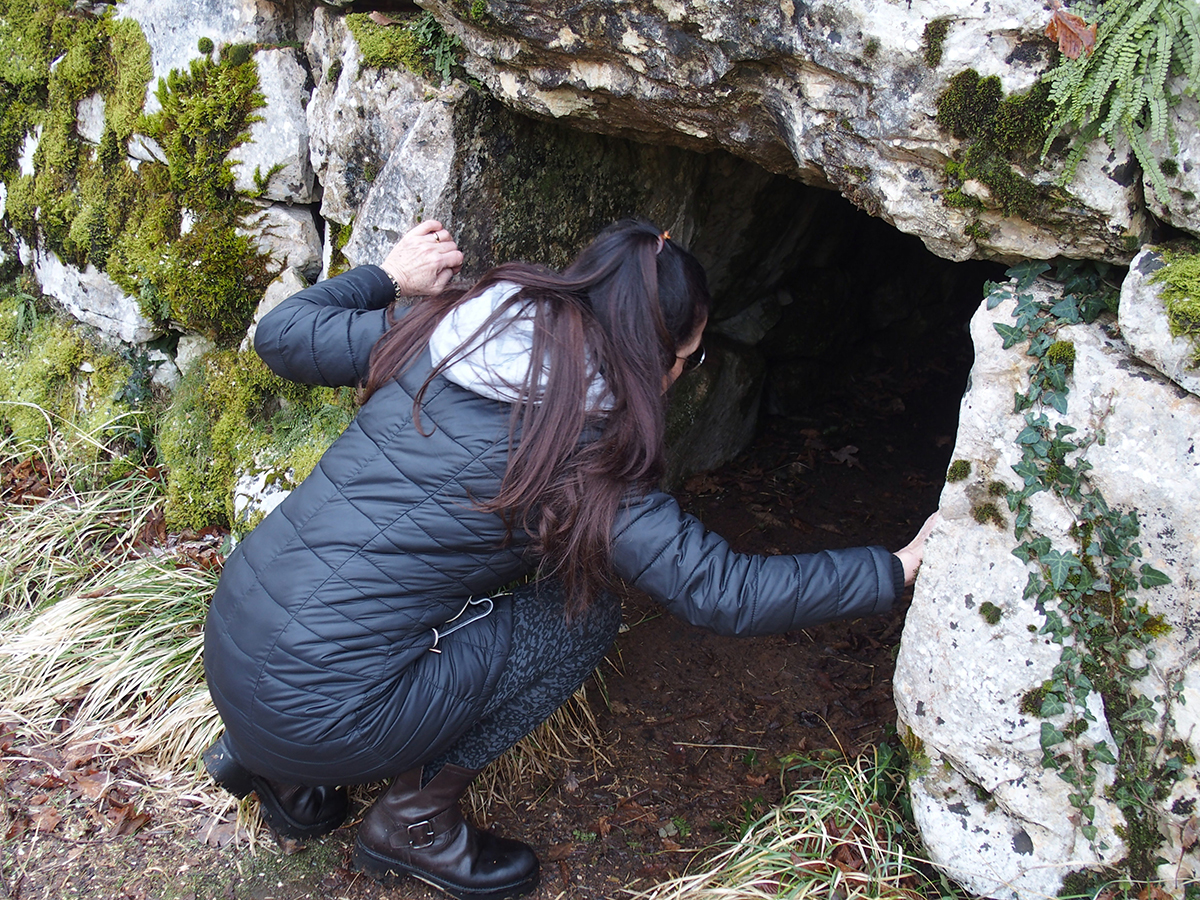
Particolare dell’ingresso della camera ipogea
*
*
*
Le ipotesi sulle origini e la funzione di questa enigmatica struttura sono molte :
- tribunale celtico dotato di cella sacra, usato dalle tribù locali intorno al I-II secolo a.C.,
- tempio celtico dedicato al Dio Cernunnos,
- sede dei Bugomilli, una setta eretica cristiana che nacque nel XIII secolo anche in Serbia e in Bosnia e successivamente influenzò le nascita del movimento dei Catari,
- teatro istriota (nelle vicinanze della dolina, è stato ritrovato un antico caravanserraglio per il bestiame.
*
Particolare dell’ingresso di una seconda camera ipogea
La presenza di numerosi menhir posizionati nel sito fa pensare ad una funzione astronomica della struttura che però, ad oggi, non è ancora stata presa in esame.
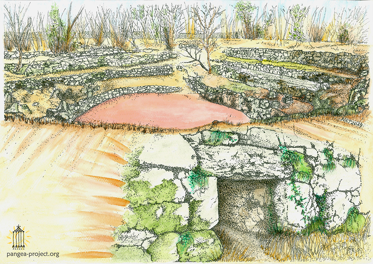
Acquerello della dolina di Bugomili di Natalia Tarabella
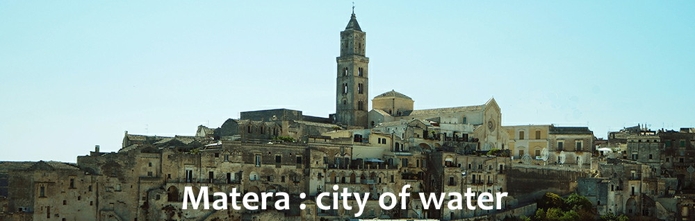
Matera : City of water
*
In the Sassi of Matera, the excavation of the caves drains the slope and the inside of the cliff, making the cavities usable, and realizing the water reserves for the inhabitants and the cultivations on the terrace.
With the same excavation materials, the houses are built, extending the perimeter caves of each terracing and creating protected courtyards.
Here, rainwater is captured in the well by the roofs that have the sloping walls inside the masonry.
A community life around hypogea that keeps a constant temperature of 15 degrees and provides warm during winter and cool in the summer season.
The plot of narrow streets and ladders is used to channel the rainwater that feed the terraced cultivations.
With urban growth, terraces are saturated with dwellings and turn into hanging gardens.
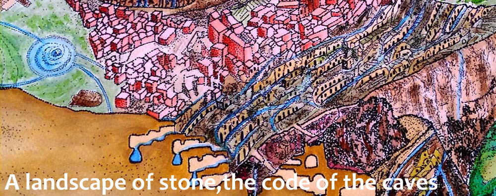
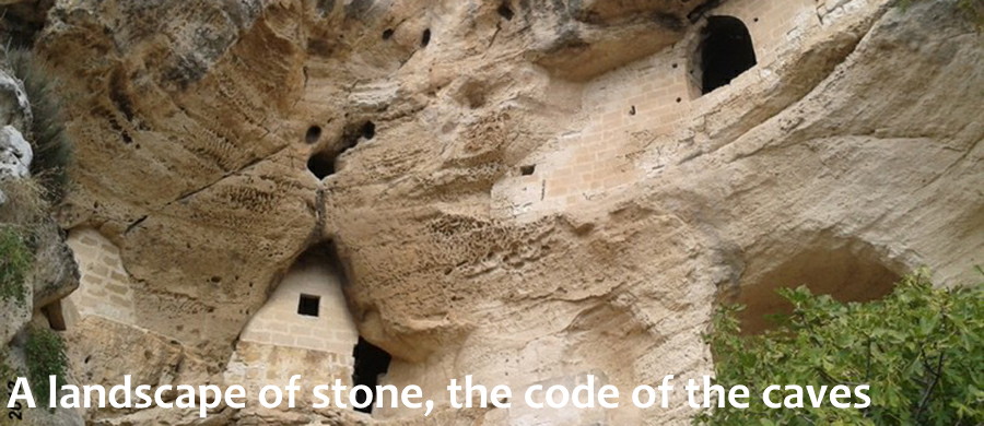
A landscape of stone, the code of the caves
*
Rocky environments and stone towns are a model with low resource waste.
The communities that built them were able to renew the resources of ecosystems without waste.
Thanks to the great ability to adapt to extreme survival conditions, they have allowed the continuation of the human species.
A landscape of stone, the code of the cave
*
In the caves, where spontaneous water dripping occurs, it digs to follow and intercept the flows.
They enlarge natural swallows by providing them with openings on the slope wall and drainage and collection tanks.
These practices will evolve in the hypogeous techniques of drainage tunnels and passive architecture that, in suitable geomorphological situations, will become troglodytic settlements and stone towns.
The first circular courtyards with radial tunnels were created thanks to the activity of mining flint.
The model is reproduced in water collection devices and housing systems formed by central court hypogeas.
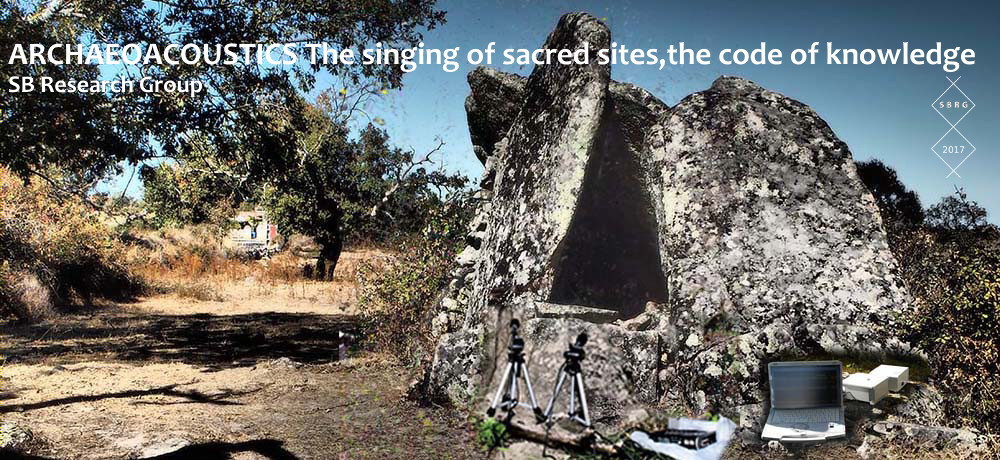
ARCHAEOACOUSTICS The singing of sacred sites, the code of knowledge
*
When the first hominids appeared on the Earth, given the difficult living conditions they adopted techniques for survival.
The people surviving thanks to the shelter and warmth offered by the caves.
These, ensured an effective thermal insulation and provided shelter to the fury of fierce elements and wild beasts.
The senses were highly developed and the sounds, ultrasounds, vibrations and energy fields were perceived by man instinctively and naturally.
Probably by the time he learned how to refine these perceptions by fostering the ability to transpose the energy of a place and the effects on the human body.
And it’s just inside shelters like caves, which began to erect the first monuments tied to sacredness and functionality.
The caves were equipped with pits excavated to collect water, but they also assumed a ritual charge, as evidenced by many representations and carving found to refer to sacred rites.
When, then, man began to build sacred artifacts outside the rocky environment, the position of these structures was probably chosen according to the vibrations and sounds that the place emanated and that they perceived in an amplified manner.
There was the combination of beauty, sacredness and functionality; these three aspects the basin which were characterized the heritage of mankind, were the basin which characterized the heritage of mankind the overall unity between MAN, the ECOSYSTEM, and COSMOS.
Considered, therefore, archaeoacoustics ( “archaeology of sound”) as a modern science is incorrect if we think that man in the past naturally perceived sounds and ultrasounds and channeled the positive energy of a place in favor of its own body.
In the modern age, in order to capture these sounds, we need sophisticated instrumentation that allows us to hear the voice of sacred structures dedicated to the cults and the most cases of difficult interpretation on our part.
Archaeoacoustics is a complementary approach to analyze any archaeological site with interesting acoustical properties.
It can demonstrate characteristics that may well have been incorporated into the design by the architects.
Archaeoacoustic research can also help us to understand how such structures affect brain activity, for example during rites where an altered state of mind intensifies the experience.
Natural phenomena can also influence the psycological state, for example by inducing mystical state.
We have demonstrated ancient civilizations had some knowledge of this, through understanding the significance of specific locations.
Using digital recording equipment, non-audible sound frequencies can be recorded.
These have a direct effect on the human body and mind even if the person is unaware of their existence.
Some archaeological sites feature a measurable natural audio or electromagnetic phenomena that enhances its “mystical” properties.
Interesting archaeoacoustic effects have been discovered at a number of sacred sites.
Incorporating a neurophysiological approach, is adding weight to this hyphotesis.
Under laboratory conditions, we reproduced frequencies found at a number of sacred sites in UK and Ireland.
The results confirm these frequencies interfere with the human body sometimes doing so without a person being aware of the mechanical vibrations at play. (Volunteers examined by EEG)
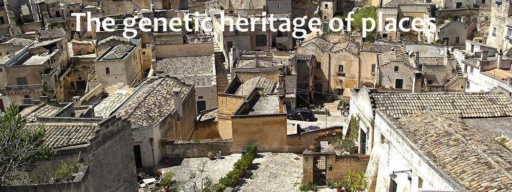
The genetic heritage of places
*
Can we talk about a genetic heritage of places?
The “gravine” are very evident orographic phenomena in the particular geography of the Apulian-Lucan territory.
Natural fortresses rich in shelters and ravines, large valleys formed by calcareous rocks suitable for excavation and construction, plateaus that favor the collection of water.
The gravine offer multiple conditions widely used by the agro-pastoral civilization of the Murge.
We can speak, therefore, of a genetic heritage of the ravines, of a common DNA of a whole territory where the places are similar, the environments are equivalent; self-similar places.
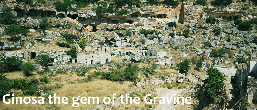
Ginosa the gem of the gravine
*
The line of the gravine that runs from Taranto to the north and the interior formed by Massafra, Palagianello, Ginosa, Laterza, Matera up to Gravina di Puglia, was an itinerary used by those peoples who knew the technology of metal smelting.
These peoples spread through the Mediterranean in search of minerals.
The gravine represent a cultural example of union between Nature and Man but risk being forgotten.
Like the city of Matera, abandoned for years, even Ginosa today risks collapse.
The hydrological disturbances caused by overbuilding, by the abandonment of the terracing and by the lack of accurate water management, have provoked flooding, causing the collapse of almost all the facades of the houses.
Knowledge of communities to face water scarcity
*
The situation of land degradation, the abandonment of late agriculture, the occupation of spaces by large infrastructures that prevent the environment from balancing the phenomena of weather, triggers a series of catastrophic events on our territory and water, as a beneficial factor, it becomes a dangerous element.
Humanity has always addressed climate change, the collapse of ecosystems and environmental disasters.
The reservoir of local techniques and knowledge have ensured the survival of the human species.
Today, the immense construction of buildings in alluvial areas, the overbuilding of riverbeds, the abandonment of the mountains and land management techniques, the construction of large river basins, have caused a series of increasingly frequent cataclysms, such as torrential rains, tornadoes, landslides and sudden flooding,
In order to tackle these serious problems, a different approach is needed than the one adopted so far. Sustainable development, alternative energy sources, are some of the proposals that, together with the cultural heritage and local knowledge of each specific place, can bring about change.
Culture and science have developed thanks to the great wealth of traditional techniques that have allowed the creation and management of wonderful landscapes in various parts of the world.
The development of these ecosystems requires a low use of energy and resources, these environments adapt to climate change and react to cataclysms in a flexible way.
Unfortunately, many of these sculpted landscapes, such as cultivated terraces, are now abandoned causing the collapse of vast areas.
It is therefore necessary to intervene also at an architectural and urban level and develop a program that intervenes on the conservation of soils, on the collection of rainwater and on the recycling of waste for the creation of an architectural landscape similar to the” harmonic garden” of the past.
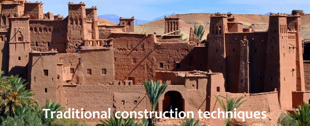
Traditional construction techniques
*
Raw clay structures
In the Sahara, the red desert land is still mixed with water and straw to increase the binding capacity.
By means of wooden molds, rectangular shaped bricks are modeled.
Through Spain, the Andalusian word “adobe” is used to refer to structures made of earthen bricks.
Dried in the sun, the bricks become resistant and the thick walls of the houses, create a perfectly isolated interior environment, suitable for torrid days and cold winter nights.
The rooms, inside the houses, do not have a precise function, but their use depends on the seasons and the climatic changes.
The terraces, surrounded by high brick walls, are transformed into ventilated rooms and as a roof, on hot summer nights, have a starry sky.
The most archaic construction system in the Sahara used raw brick walls and semi-spherical shells. This technique is still used for the perimeter walls of the cropping areas.
The method of laying these walls is very similar to the convex brick wall works produced in Mesopotamia in the III millennium.
A wicker basket is used as a mold and the bricks, after being dried in the sun, are arranged in alternating oblique strips to form a herringbone pattern.
The interstices of the walls, form a sort of perforated decoration, a suitable protection against sandstorms.
A completely closed barrier, in fact, would cause piles of material carried by the wind and the plots would, gradually, be buried in the sand.
At night, the wind blows against the convex sides of the bricks and releases moisture into the earth whose walls are composed.
During the day, the hot wind penetrates into the interstices of the wall and reaches the gardens where the value is absorbed and the temperature decreases.
The sites of Catal Huyuk in Anatolia and Jarmo in Iraq, are Neolithic settlements made of “adobe” bricks just like the first houses of Jericho.
The adobe habitats of homes in the oasis of the Sahara are very similar to the buildings of Catal Huyuk and are still inhabited today.
The raw earth is used to meet the climatic conditions of the environments and the need for careful use of natural resources.
This type of construction system continues to be used in California, in southern Italy and in the Hadramaut valleys in southern Yemen, where the raw earth is still used for the construction of complex city systems organized in the arid courses. wadi and where this ancient knowledge has been perpetuated for centuries.
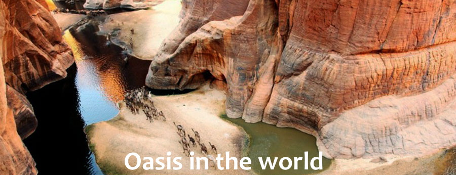
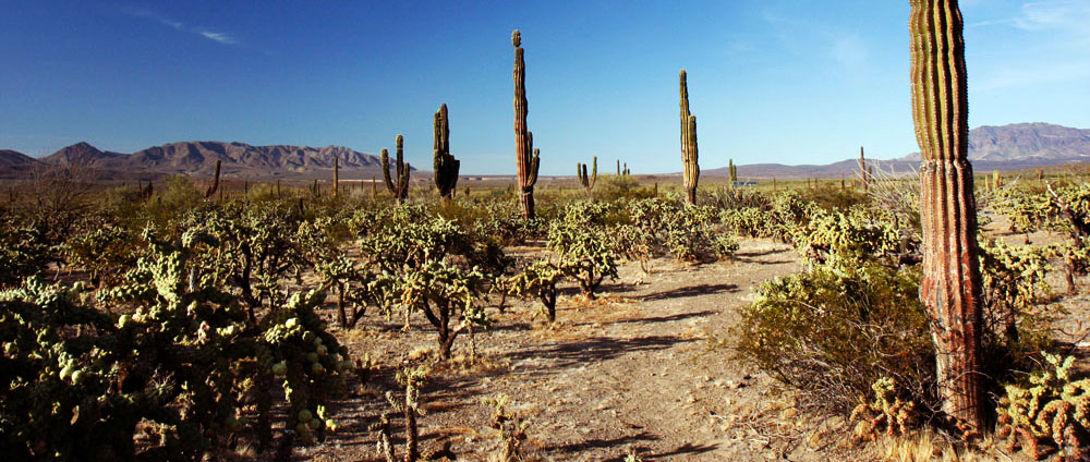
Oasis in the world
*
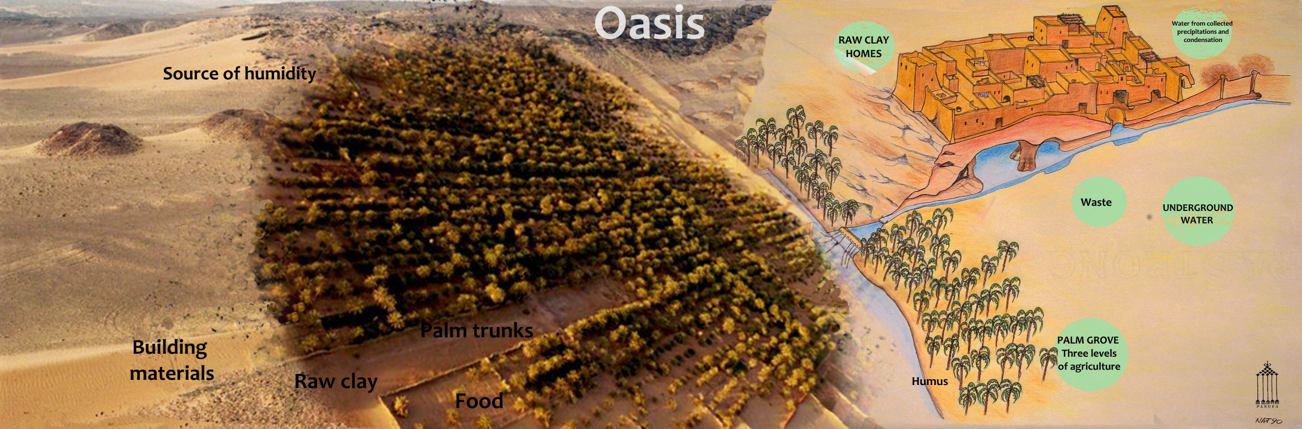
The oasis is a self-sustainable vital niche, a human settlement that manages, in arid environments, to exploit the few resources available locally, creating a fertile ecosystem in territories where conditions are unfavorable.
Small niches, depressions of the ground, lines of stones gather moisture; a plant is born from a small seed.
The tree makes shade, concentrates steam, attracts insects that, by dying, create the humus nourishing the plant.
A single palm tree, planted in a sandy valley surrounded by dry branches, is protected from sand carried by the wind.
From this microcosm, exploiting ancient local knowledge, vast crops are grown surrounded by dunes and fed by branched and technically complex water systems.
*
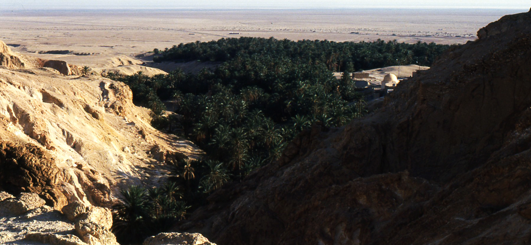
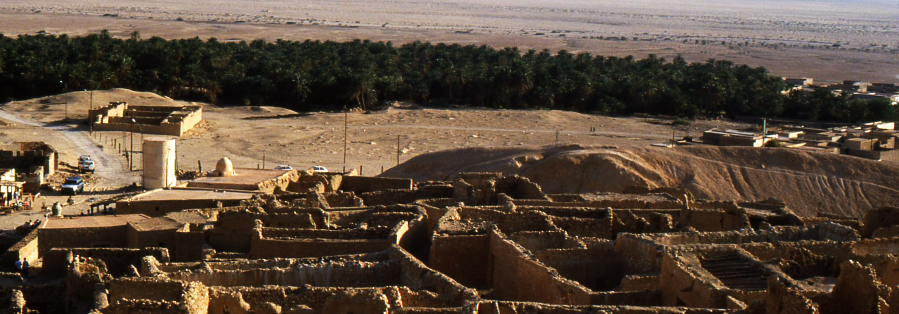
The oasis is not only deserted but also a STONE OASIS.
In situations where the climatic conditions with precipitations concentrated in a few months a year follow one another in arid seasons that determine a disastrous alteration, the water must be managed in an accurate manner, being inexistent to the lake and river state.
In the gravine different principles of water management are used: captation, distillation and condensation.
When the rains are abundant, the terraces prevent the erosion of the slopes and convey the water in the cisterns inside the caves.
RELIGIOUS OASIS, carved in the erosion valleys of Cappadocia, Palestine, Tebaide and Ethiopia, are organized as hermitages and walled gardens irrigated by draining tunnels, cisterns and canalizations.
MARINE OASIS, they are widespread in the arid islands or on the coasts of the Mediterranean or in the Red Sea and are fed by air sources.
RAINFOREST oases like in the Yucatan.
MOUNTAIN OASIS like Tamerza and Chebika in Tunisia.
*
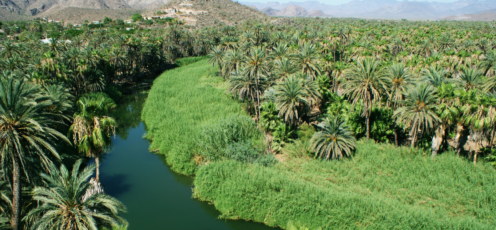
Oasis settlements in Central America (Mexico)
Baja California Sur
The numerous research carried out over the years, have found that there are 171 oases in Baja California Sur in Mexico.
They represent only 1% of the total territory but, they include a wide biological diversity.
The main difference between the oases of North Africa and the oases of Baja California is that they have almost completely lost their function: agriculture is lacking.
They have, however, a very important role of wetlands and islands for endemic species.
The Spanish missionaries, in the XVIII century, introduced the date palms to create the necessary shade to increase the humidity, anthropising the environment for agricultural purposes.
The main purpose of the oasis was to create irrigated areas that encouraged the development of stable settlements by consolidating the Spanish and Christian presence in an arid environment.
*
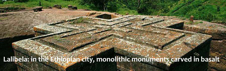
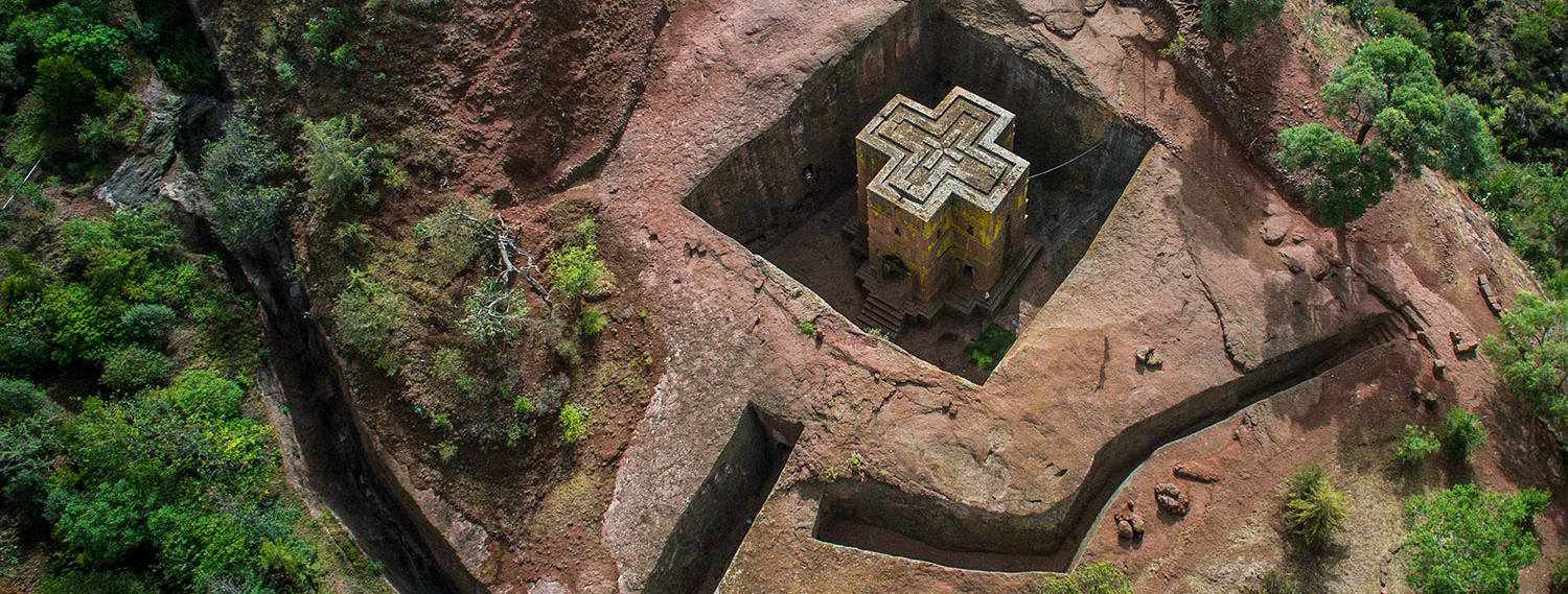
Lalibela : in the Ethiopian city, monolithic monuments carved in basalt
*
They collected water in the tanks and watered the gardens.
Without constant maintenance, over time these structures are filled with debris and deposits causing moisture to stagnate.
The in-depth study of one of these churches, showed that the inner courtyard in which a large tank was dug was probably drained from a large moat now covered with sediments.
The moat is equipped with side cavities and water regimers.
Continuing to clean up the moat, the structure began to function as a drainage device and excess water control, keeping the court and monument dry.
Rainwater accumulates at the bottom of the moat which, in this case, works as a collection tank that is used by the inhabitants of the city.
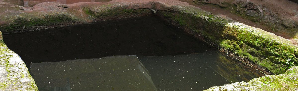
Sacred pool
The urban structure of the Lalibela hypogean city emerges through the ditch plot that identifies the built space, made up of monuments, homes, fortifications, and hydraulic systems and irrigation of gardens.
The harmonious plan of Lalibela, perfectly integrated in the environmental context, is highlighted through the drawing of the ditches excavated in the rock.
*
In order to safeguard the churches of Lalibela it is necessary to understand how, in the past, the inhabitants could protect them from the rain by ensuring the drainage of all areas around the monuments.
This will allow you to remove the existing outer shells by restoring the original landscape look.
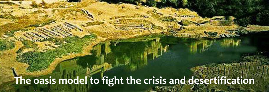
The oasis model to fight the crisis and desertification
*
*
The oasis settlement is an autocatalytic system in which an initial supply of condensation and moisture is extended by planting trees that produce shade and attract organisms, forming humus. The palm grove creates a humid microclimate fed via the foggara tunnels by gathered precipitation, condensation, and underground drainage.
The village, made of raw clay, does not involve the waste of wood for the firing of the bricks and the houses are cooled by underground path of water which also feeds waste for fertilization to the fields. The system manages water resources in a cycle of use that is not only compatible with the renewability of the amount available, but it increases the available amount of water.
*
The variety of products obtained as dates, figs, olives, is possible thanks to the thrifty use of water.
The cultivations are subdivided into levels of which the first consists of date palms which, with their high vertical development, provide shade to fruit trees of lower height.
Fruit trees, in turn, can create an environment suitable for growing vegetables.
This simple technique, prevents the evaporation of water due to direct exposure to the sun and allows an accurate management of the available water system.
Heritage for Planet Earth
*
*
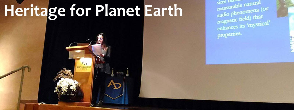
Heritage for Planet Earth (Florence 2017)
Archaeoacoustics in archaeology
dott.arch. Natalia Tarabella, prof.agg. Paolo Debertolis
Abstract — Archaeoacoustics is an approach to analyze any archaeological sites that have interesting acoustic characteristics or natural physical phenomena affecting brain activity.
It can be used to demonstrate for example sound occurrences incorporated into the design of the ancient structures by the architects.This is not the only application, following an
anthropologic approach, archaeoacoustics can explain why during rituals an altered state of mind intensifies the experience.
In fact natural phenomena, now scientifically measurable,
influence the psychological state of the people by inducing mystical states.
Over seven years of research in this field we have demonstrated ancient civilisations had some knowledge of this phenomena,
through understanding the significance of why specific locations were
chosen for buildings such as temples. Using digital recording equipment, it is now possible to record non-audible sound frequency bands.
These bands have a direct effect on the human
body and mind without a person being aware of the existence of their accompanying mechanical vibrations.
Keywords – archaeoacustics, ultrasounds, infrasounds, low sound frequency.
ARCHAEOACOUSTICS III

*
Tomar, Portugal 2017
Fireplace and Holy Altar in Curiceta at Apuan Alps, Italy
Natalia Tarabella, Paolo Debertolis, Daniele Gullà, Lorenzo Marcuccetti
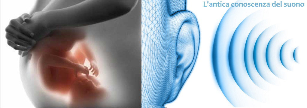
The ancient knowledge of sound
*
During the nine months of gestation, the fetus perceives the pulse of the maternal heart.
It is the first sound that the human being still listens before seeing the light.
A sound, at a steady pace, that will be part of its genetic heritage.
It’s the beat that marks life.
For the first hominids on earth, this patrimony was the guarantee for their survival.
The smell, the sight, and above all the hearing, were surely amplified and transmitted as animals with which they shared the outer space.
Living in symbiosis with nature, devoid of any form of pollution, perceived sounds, ultrasounds, vibrations, and energy fields instinctively.
By the time, they learned to refine these perceptions and gained greater reception power of the energies emanating from a place and the effects they caused on the human body.
Everywhere, it matches a sound,a frequency, a vibration, of a place also listen to silence.
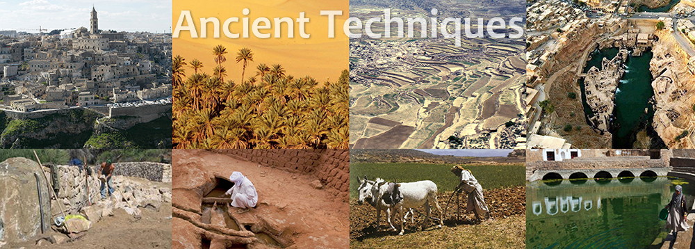
Ancient Techniques
*
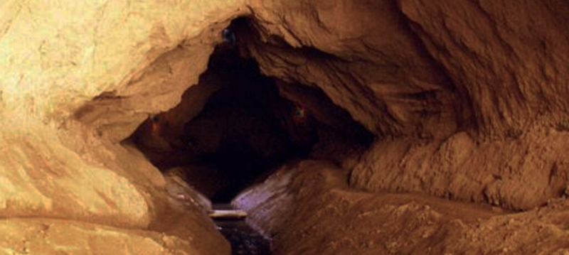
The mines of water: kilometers of underground tunnels
The underground drainage tunnels have a very ancient origin and are used in an extensive area that goes from China to Persia, to Spain, to Latin America.
At the foggara sahariane correspond, with different characteristics, the Persian qanat, the Arab falaj, the Moroccan khottara, the Andalusian madjirat and very similar waterworks have been found in Peru and Mexico.
The foundation of the oldest cities was linked to the realization of these devices
Near the megaliths and areas bearing ancient Libyan-Berber inscriptions, the archaic custom of laying a stone on platforms-sanctuary called mzara was perpetuated.
Sometimes, the nearby Islamic mausoleum attests to the uninterrupted use of the sacred place often placed at the mouth of the foggara.
This overlap of prehistoric sites and water points still used is recurring throughout the sahara: in the El Guettar deposit at Gafsa, the palaeontological mound dating back to the Mousterian is inside a foggara.
*
In Gourara and Touat, about half of the thousands of reviewed foggara are still working and capable of abundant water production.
All the subsoil is gutted by the network of tunnels and on the surface, long rows of wells, recognizable by the characteristic border formed by excavation debris, allow to identify the underground track.
Places at a distance of about 8-10 meters from each other, guarantee ventilation during underground work and serve maintenance work, but not to draw water.
The excavation of the foggara is started from the place where the village is located, at the edges of the sebkha.
Proceeds going up towards the erg or towards the Tademait plateau where the galleries stop because they meet the dejection cones of the ancient wadi.
The tunnel sunburst, parallel to the course of the stratum, drains the roof of the depression, absorbs the liquid and conveys it by gravity towards the basin.
Generally the tunnels are only large enough to facilitate excavation and maintenance work and have an ovoidal section that narrows at the base where the water flows.
The ancient quadrangular fortresses of raw earth, located at the outlet of the foggara, constitute a compact complex, surrounded by walls to protect the underlying agricultural area, the conservation of food, the control and distribution of water resources.
The cultivations of vegetables need a system of constant water distribution.
These are distributed, at the outlet to the surface of the underground canalisation, into a triangular basin (the qasrl) through a particular comb-shaped stone device, called kesria and forms the basis of qasrl.
Archaeoacoustics in Sahara
Using modern digital recording techniques it is now possible to record very clearly the inaudible sound frequency bands.
These inaudible bands, such as ultrasound or infrared, have long been known as being able to change the trend of brain activity subjected to these frequencies, particularly infrasounds.
It is also possible to make visible and view magnetic fields capable of to change the state of the mind
It is important to understand the relationship between ancient sites and people who built them.
So archaeoacoustics should not only analyze the acoustic properties of the site, but also all the physical phenomena associated and not perceived by the ears that could have influenced the population in considering a particular site as sacred.
*
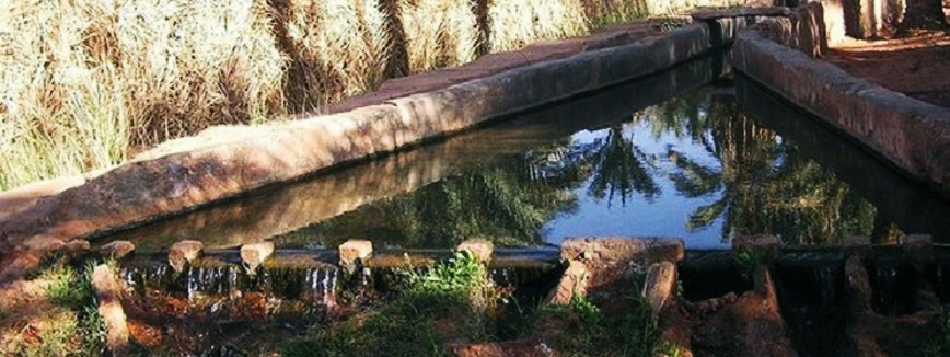
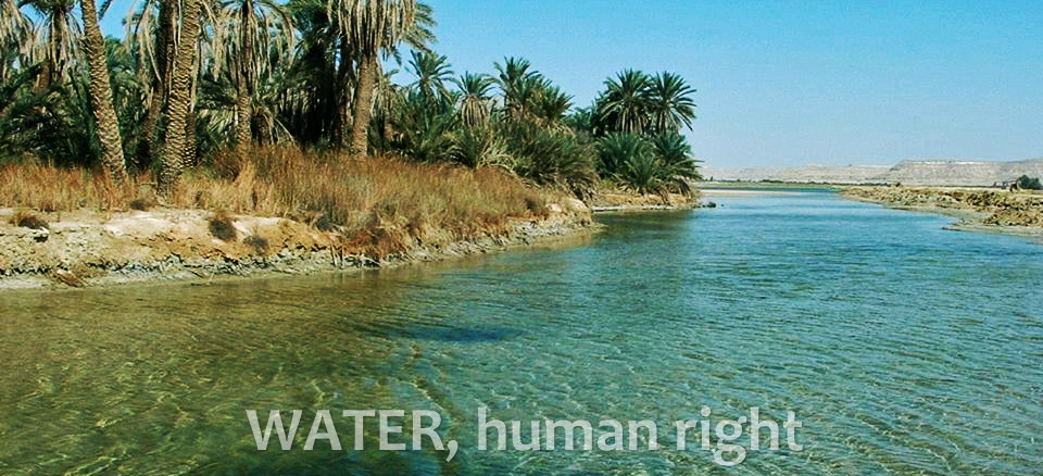
WATER, human right
*
Bell cisterns
Large bell-shaped cisterns were dug into the caves to collect the water that descended from the slopes, conveying it into a network of small canals.
In some circumstances, a cistern built in the lower part of the cave is filled with water even if it is not connected to the channels.
In this case the cave absorbs the external moisture that condenses on the lower cold wall and goes down into the cistern.
In pre-Columbian civilizations the practices of landscape modification to build large-scale rainwater harvesting systems creating water intakes along the slopes, dams and watersheds, precede monumental architecture and date back to the 1st millennium b.C.
The entrance is as narrow as possible to reduce the puncture area of the more resistant surface layer.
It allows the passage of the digger that enlarges the excavation in the subsoil and forms a pseudo dome.
The perfectly smooth parabolic shape had spread since the Neolithic when the cisterns were not whitewashed, in fact, if the limestone is intact, it makes the cisterns impermeable forming a surface coating.
In ancient and medieval times the walls of the cisterns were insulated with lime-based plaster and shards, called coccio-pesto.
The cisterns on the Murge plateau and in Matera, had an average depth of 3 to 4 meters and a width of the same dimensions in the lower part.
Each cistern had a capacity of about 9 cubic meters of rainwater that depended on the hydrographic basin created by the slope, the road network and the roof pitches.
Their urban use is now outdated by the introduction of modern networks. They are still used in rural areas and are reintroduced in the restored Sassi of Matera to produce water for sanitary purposes through a double network.
The cisterns make a substantial contribution to the decrease in drinking water consumption.
Chultun, Aguada – Yucatan
In the internal areas of the Yucatan the Maya had to solve the problem of finding sufficient water resources, in all seasons, to meet the needs of large urban areas and agriculture.
The natural reservoirs of the caves and the cenotes were not enough to supply the population with water.
Moreover, the latter were subject to seasonal changes in level, to salinity due to the connection with the underground passages to the sea or to the drying out due to tunnel obstruction.
The bell-shaped cisterns called chultun, were dug into the rock to obtain drinking water.
In the Classical Age, from the 3rd century a.D., the development of imposing cities was organized around natural depressions called Aguada, in which flowed the water collected by the dams and the cisterns along the slopes.
The surfaces of the Aguada were paved with flat stones, whose joints were waterproofed with red and brown clay.
Wells and chultuns were dug at the bottom to keep the water when the Aguada dried up.
The system is very similar to the technique of cisterns typical of the Apulian karst areas of southern Italy.
At the end of the Classical Age, around the IX century a. D., driven by defensive purposes or under pressure from the need to irrigate increasingly large areas and farmland with gravity, the Maya hydraulic technology developed so much that it made the most of harvesting systems.
Thus, the city itself with its numerous stepped pyramids, monumental architecture, paved squares and large courtyards became a great system for collecting rainwater.
The tanks were used to collect and store water.
This water is very important because it requires other vital human processes.
*
Water, science and culture
*
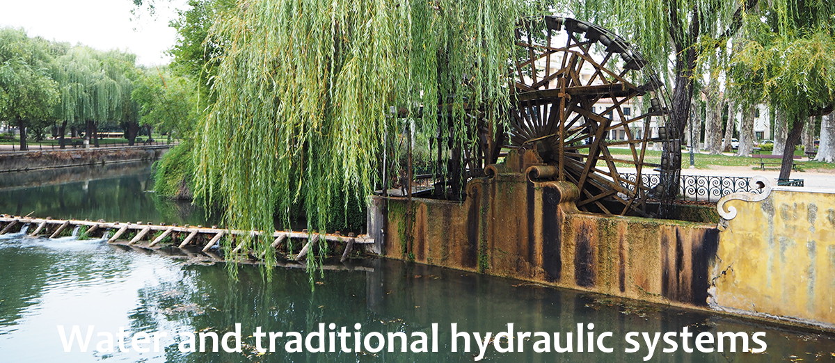
Large lifting devices (Norias)
The Noria, or Persian wheel, is a water device used as a lifting irrigation system.
It consists of a large water wheel built to lift water from the river and release it into pipelines and channels that reach the fields waiting for irrigation.
The norias are of Syrian origin and were very common on the Tigris and Euphrates to the west towards Al – Andalus.
In North Africa, the noria is found in the coastal areas of Morocco and also in the northern part of the Sahara from Tafilalet to Tripolitania.
The distribution of noria in the Iberian peninsula coincides with the area of Islamic settlements (under the Duero and Ebro rivers), although in Portugal there is a certain diffusion to the north of the Duero.
In Spain, they are particularly characteristic of Andalusia and Murcia; in Andalusia they used to take water directly from large rivers, while in Murcia they were generally located on large irrigation canals.
The famous La Nora wheel, led by the current of the Aijufia Channel, is the first example of the Murciano style.
In Syria, the Hama norias, which are among the oldest hydraulic wheels in the world, were initially built by the Byzantines as an irrigation system.
Hama is a fluvial city built on the banks of the Oronte and is famous for its 17 wooden water wheels, which once collected water from the river and directed it into the aqueducts.
Today, most of the norias are located in the city center in a public park, where gigantic wooden water wheels turn, collect the water from the Oronte river and take it to the aqueduct.
Although the system is no longer used, it is still evident how simple and intelligent it is.
The four niches of Bichriyat are located on a dam about one kilometer from the city center. The largest noria is known as Al – Mohammediyyah.
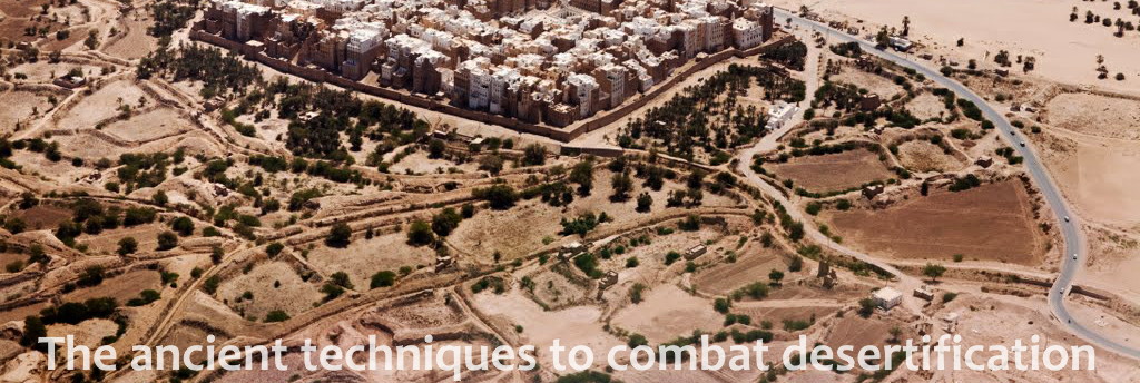
The ancient techniques to combat desertification
*
Autopoietic communities
They are communities that, thanks to internal collaboration and harmony with nature, create cycles of life and production that are able to perpetuate themselves, even in the most extreme environmental conditions, constantly regenerating themselves with high levels of independence from exogenous factors.
For communities, the union and the good use of resources are a guarantee of long-term success.
The careful relations between society and nature are found, in particular, in areas with difficult environmental conditions in which the effort necessary for the creation of things is also based on rules of humility and respect for the environment.
The desert oasis system is autopoietic for excellence, a model of close man-nature collaboration able to create life cycles and autopoietic ecosystems in all conditions.
They are able to self-reproduce in a continuous self-regeneration.
Even in such a dry and desert-like environment, specific ecosystems can be found by breaking the negative aridity circuit, the vicious process of soil depletion, amplifying the available resources to the maximum.
When communities reach levels of higher dimensions, social specialization and constructive realization, a sustainable urban ecosystem is determined: it is the synthesis of local knowledge accumulated in history and culture.
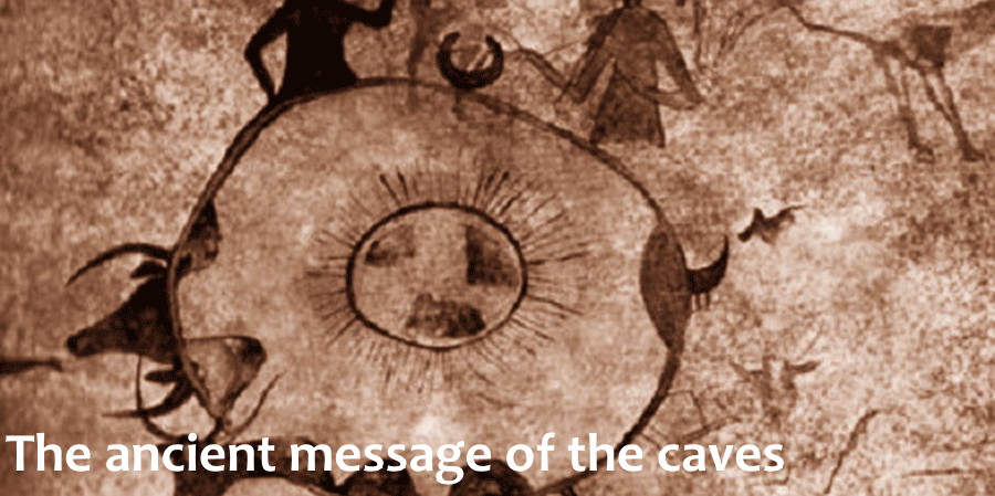
The ancient message of the caves
*
The representations and paintings of the Paleolithic and Neolithic period were not just figurative expressions but they contained a message transmitted in art and culture throughout the history of civilization.
Each community has its own vision of the world and the rock depictions constitute the symbolic classes with which they are identified.
The cave is the first temple, the place of social union where the community begins.
The ancient message of the caves is a valid example for the entire planet.
*
PANGEA OASIS The project : the Springs of Malbacco
*
THE PROJECT – The objectives of the project “Pangea Oasis” are an ecological architecture, a landscape preservation, ecosystem restoration and safeguarding the Springs of Malbacco.
PRODUCTION AND USE OF COMPOST
For an ecological architecture, special toilets will be used that separate liquid waste from solid waste, for recycling organic remains and compost creations. (Aquatron)
AUTOPOIETIC SOCIETY
Production and use of compost
The type of autopoietic society, even in the most extreme environmental conditions, can create cycles of life and production regenerating itself continually and is able to self-reproduce in a continuous self-regeneration.(Shibam (Yemen) – Saharian Oasis)
The model is based on the close relationship between man and nature, respecting the environment in relation to the difficult conditions of life that requires greater efforts for the creation of things.
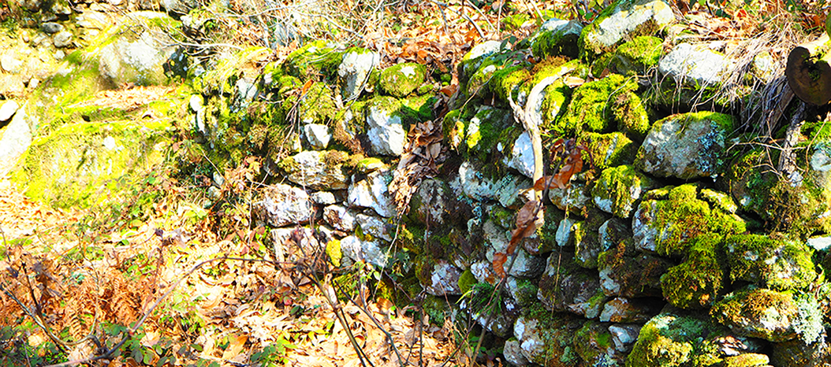
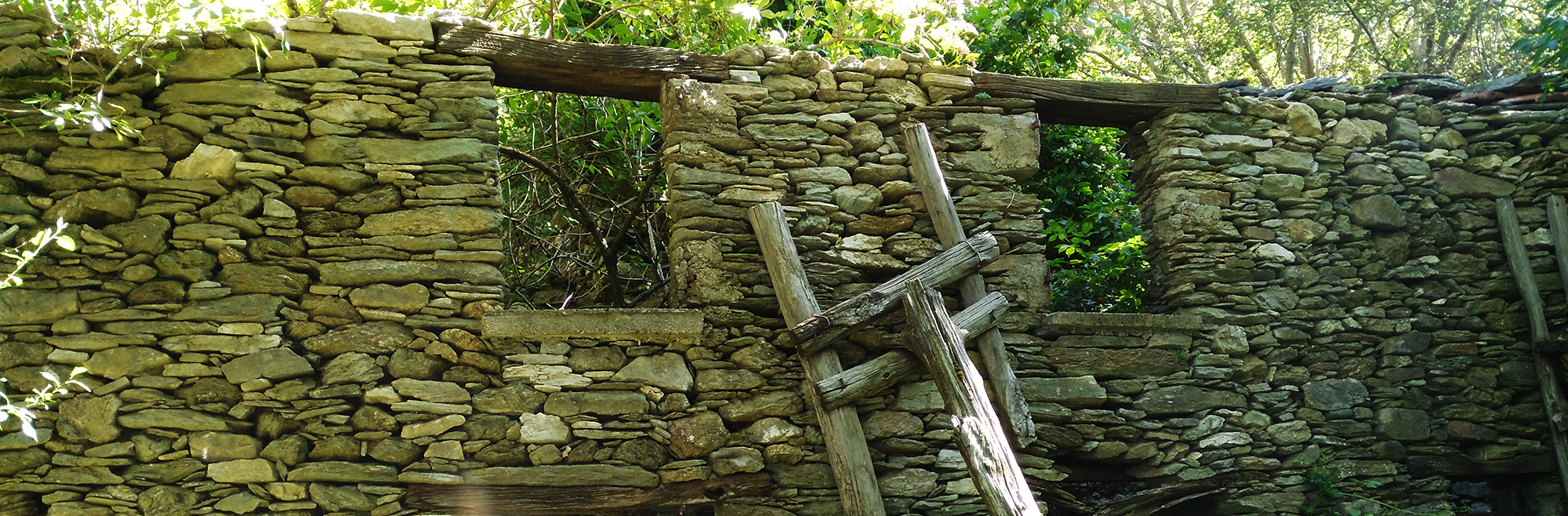
The Springs of Malbacco and neighboring areas (High Versilia, Italy)
The project includes:
LANDSCAPE PRESERVATION
RESTORATION of small and large terracing
RECOVERY AND RENOVATION of the dry stone walls
The dry stone terraces are the safeguard for the montains ; soften the slope, retain the land avoiding landslides and are a landscape wealth of this area.
*
*
THE TRUE SOUL THE CITY OF PETRA A paradise of water and gardens
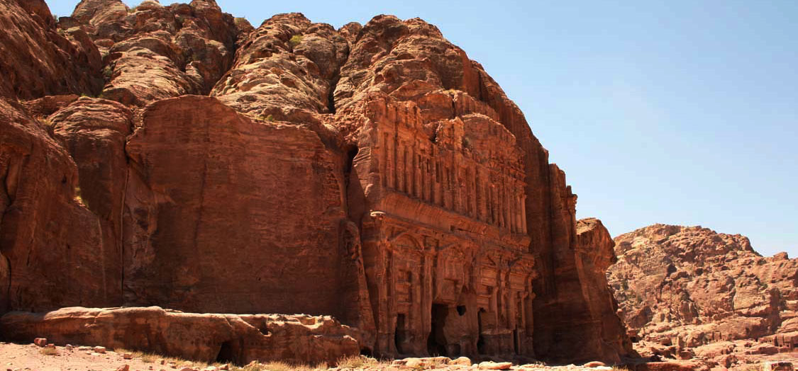
Detail on the left of the Palace Tomb: after having supplied the troglodyte dwellings along the Wady al Matha, the water coming from the aqueducts fell from a monumental waterfall.
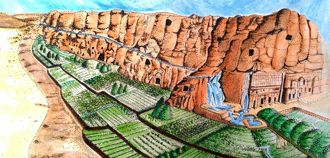
Acquerello di Natalia Tarabella modificato da “Water Atlas” di Pietro Laureano, 2001 Bollati Boringhieri editore s.r.l. Torino
Graphic reconstruction of what Petra presented in antiquity. An ecosystem of waters and gardens with cultivated terraces and hydraulic structures.
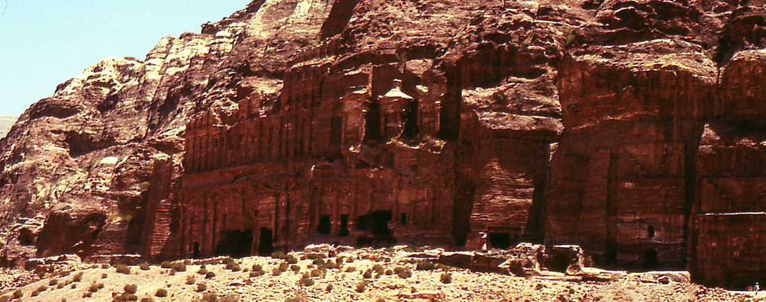
The wall with monumental tombs that open onto the rocky massif of El Khubtha.
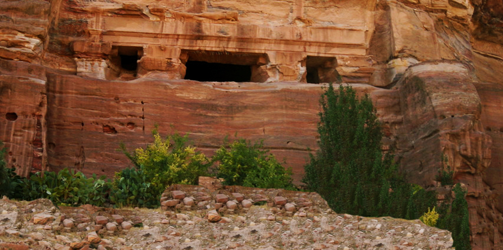
Remains of ancient terraced gardens and houses with water collection systems.
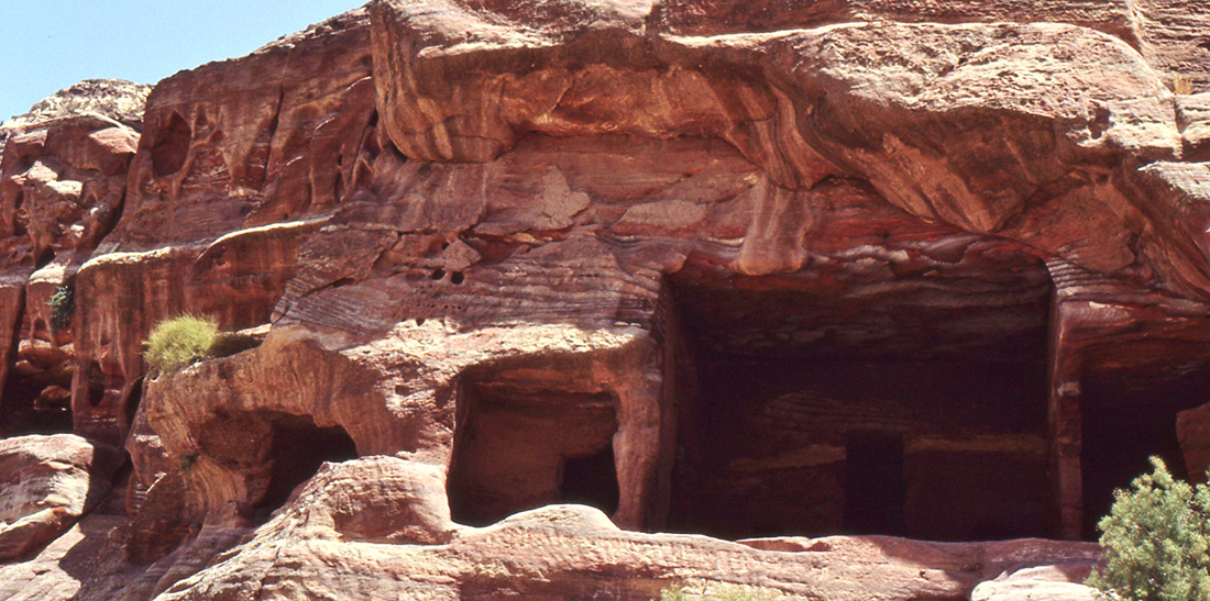
Troglodyte dwellings.
Water and traditional knowledge
E’ l’acqua l’origine di tutta la vita sulla terra e questo è il segreto delle antiche città
HERITAGE FOR PLANET EARTH 2018, FLORENCE
FIRMA DEL MEMORANDUM LIFE BEYOND TOURISM SB RESEARCH GROUP
Dott. Paolo Del Bianco,Life Beyond Tourism – Arch. Natalia Tarabella, SB Research Group
*
LIFE BEYOND TOURISM

*
|
|||||
|


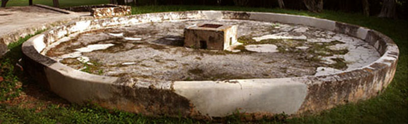
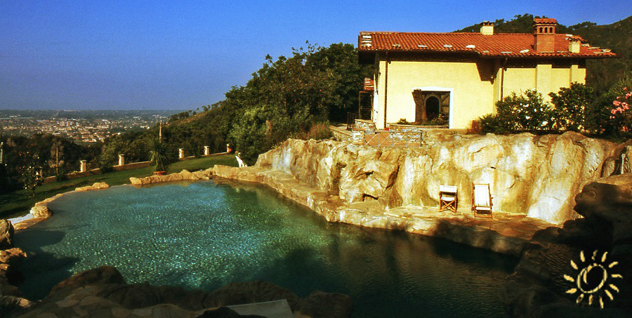
LA RACCOLTA DELL’ACQUA DAI TETTI
Raccogliere le precipitazioni meteoriche tramite le grondaie.
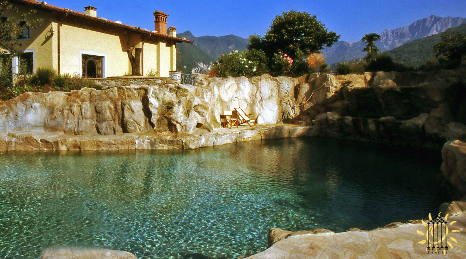
Una piscina in Toscana costruita con la pietra locale e riciclando l’acqua raccolta dalla copertura tramite le grondaie
Le nostre abitazioni attuali possono diventare autonome e produrre la propria acqua con sistemi di raccolta dell’acqua piovana dai tetti o riciclando l’acqua stessa.
In Toscana le falde dei tetti sono una grande risorsa, ogni parte della copertura diventa una superficie di raccolta di acqua.
Tutte le gronde possono essere canalizzate e l’acqua, ossigenata continuamente, viene disinfettata dai raggi solari.
Nelle foto è ripresa una villa che raccoglie acqua dal grande tetto e viene canalizzata in tubi per essere poi stoccata in cisterne sotterranee.
Dalle cisterne viene fatta girare e filtrare per la grande piscina, costruita in pietra locale, per poi alimentare le fontane che sgorgano dalla roccia.
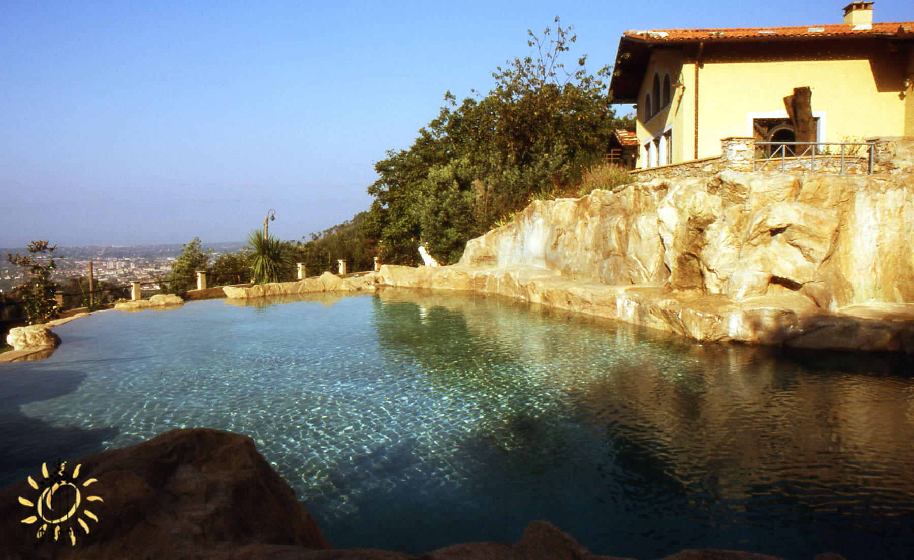
La grande piscina di roccia locale, alimentata con l’acqua raccolta dalle coperture
*