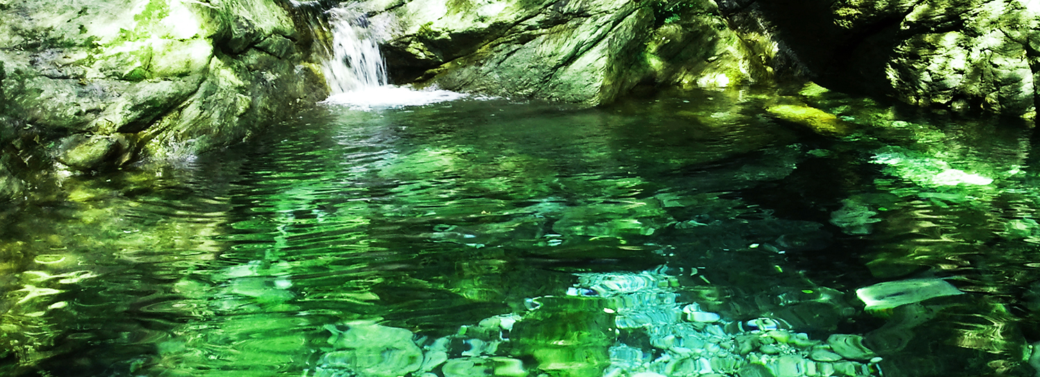
Source on the Apuan Alps
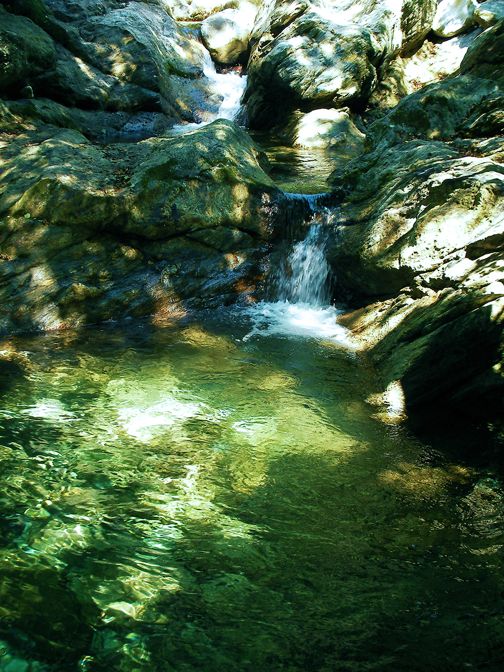
Source of Malbacco (Tuscany)
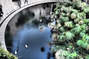
Siracusa (Sicily) Fonte Aretusa. It is located in the Island of Ortigia, the oldest part of the city. Immersed in the greenery of the syracuse papyrus is one of the springs of fresh water that reaches the subterranean roads to the Island. Flow a few meters from the sea
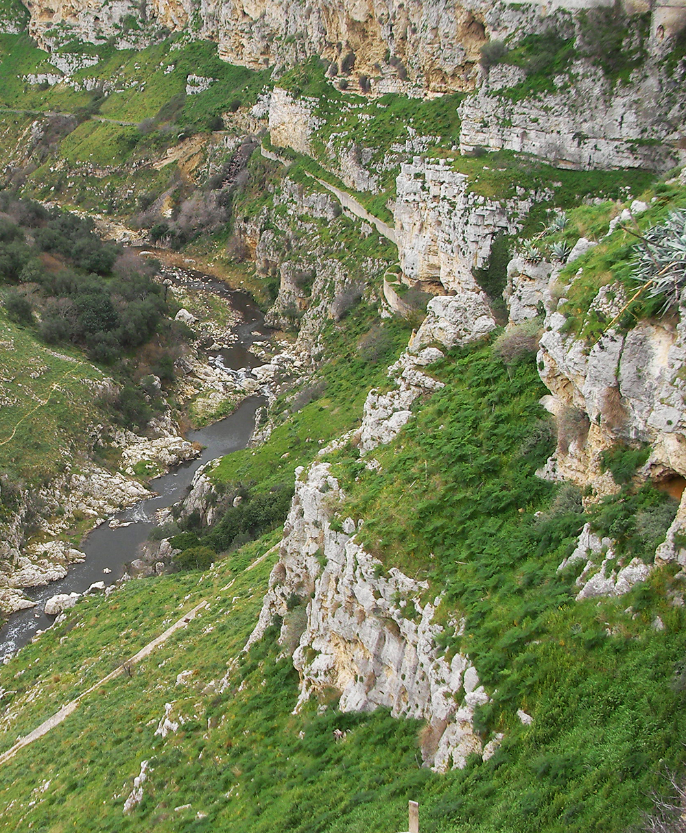
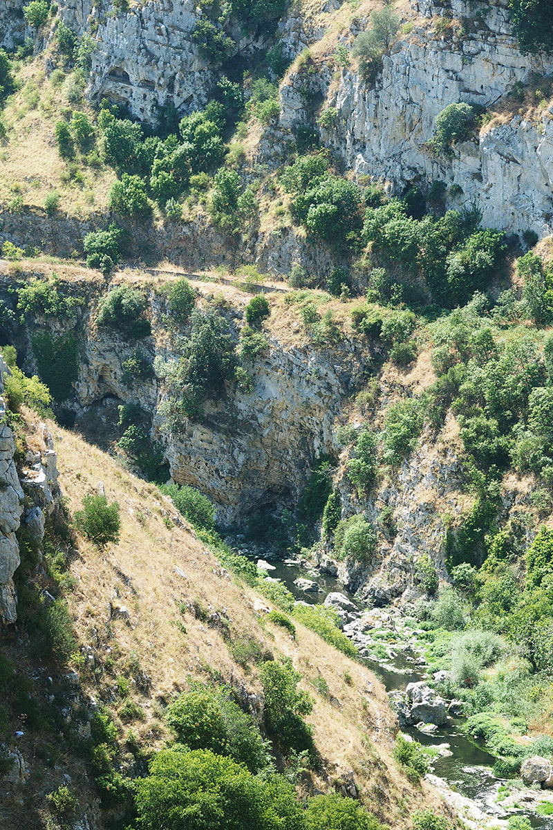
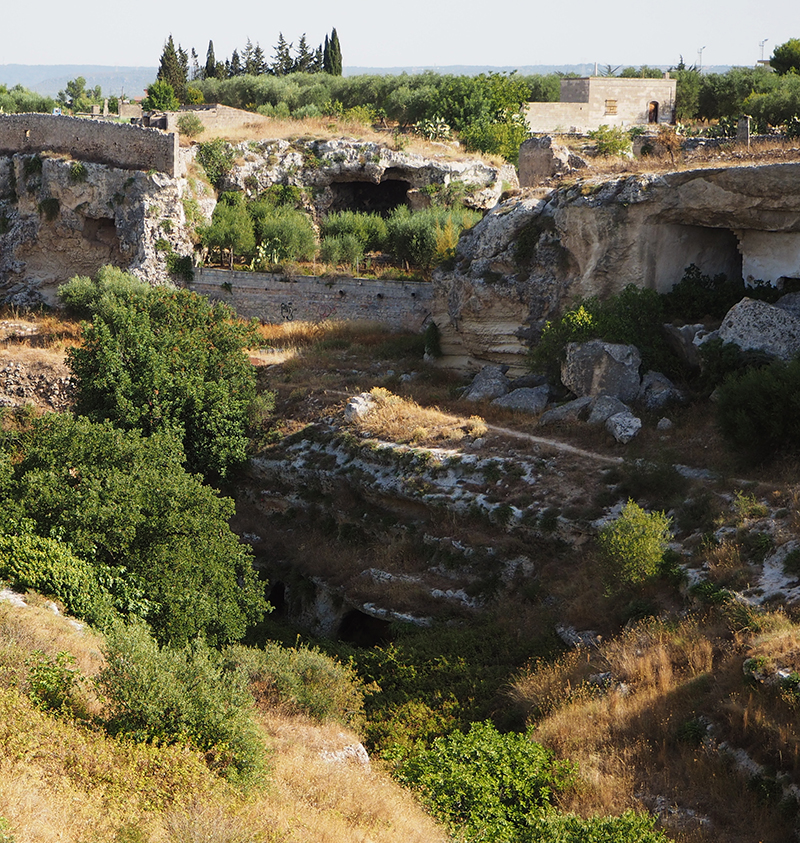
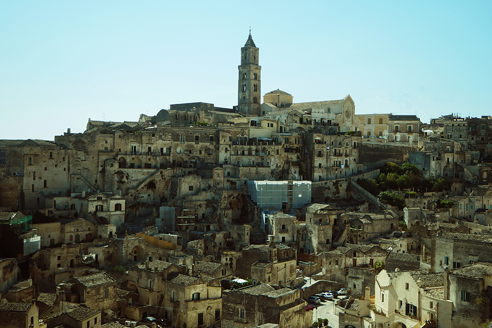
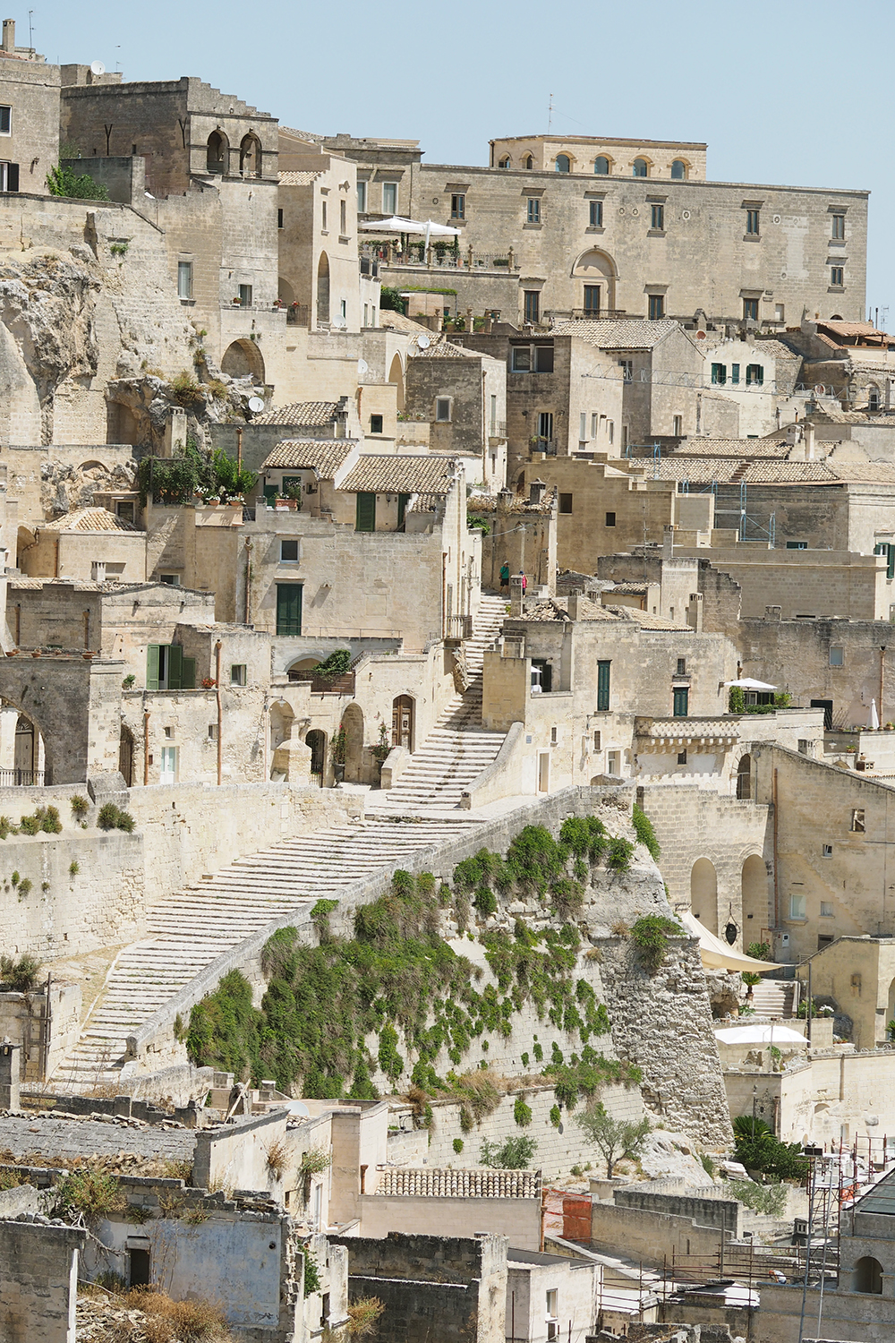
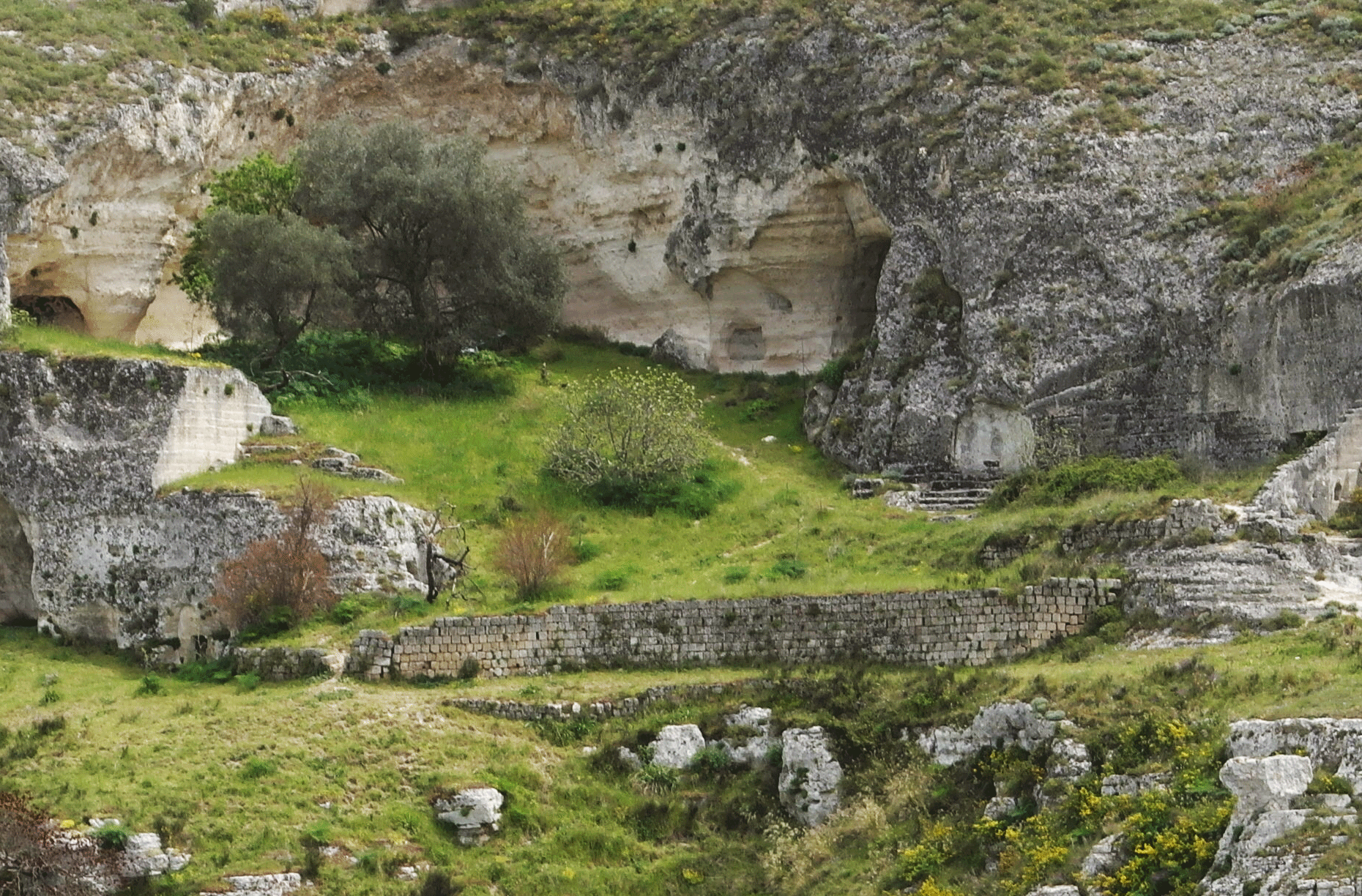
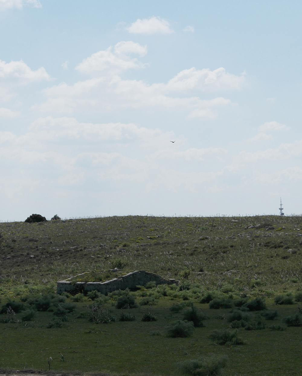
The gravina of Matera. Gravine are deep gorges, having a highly irregular water flow which characterise the edge of the Murge highland along the Ionian ridge.The gravine have favoured human presence since prehistory thanks to its microclimate and the natural caves. Water is previded by intercepting the runoff along the slopes on the edge of the highland where the settlements concentrate
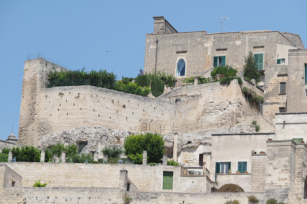
The Sassi of Matera and similar settlements located in the plateau of the Murge and extending to the city of Taranto are a prime example of how archaic societies lived and ran the resources of the karstic areas in the Lucanese, Apulian and Sicilian regions.
The cities were built on the edge of the deep gorges of the graves and had a highly irregular water flow.
The inhabitants were distributed along the plateau and steep slope instead of the bottom of the canyon that could constitute the water reservoir.
The reason is that rainy water and dew were collected in the drainage devices and in the caves that represented the great resource of these mazes, as well as in other troglody-like complexes similar to the Sassi of Matera in the stone towns of graves.
They are the synthesis of the organization of the space made by the various socio-cultural groups that have lived in these areas.
Hunters-gatherers left traces of their presence in the natural caves that open in the heavy rock of graves.
During the Neolithic Age, the limestone plateaus were populated and witnessed by the large number of densely populated villages.
In the Age of Metals, agri-pastoral populations did not conflict with previous Neolithic settlements, as they settled on the slope, therefore, there is a physical synthesis of different cultures in three geographic environments: the plain, the slope, and the caves.
An adequate system of town center was built in the Sassi of Matera, a stone oak that developed the original prehistoric techniques, thus allowing a harsh and sterile area to be inhabited by combining various principles of water production.
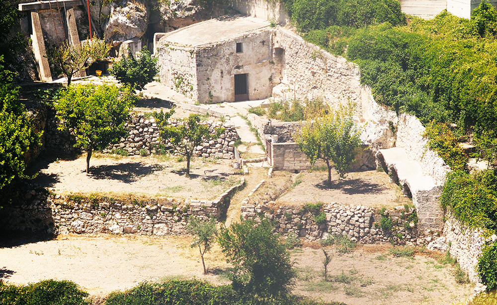
The traditional use of the constructive space of the houses saved the clay hills upstream of the canyon that were left in the woods and fruit trees.
Gravina of Matera
*
*
Above, Grottaglie (Taranto, the gravina of Fullonese) The figure shows the channel system conveying water to the terraced gardens along the slope. Below, Conversano (Bari), water harvesting system called lago. Karstic depressions and natural dolinas function by means of cisterns which intercept the water flows
The water absorbed during the rains that pours down from the gravina also comes from these hills.
Water caught on the edges of the gravina, among the valleys, is typical of karstic and limestone areas; Called lakes, characterize the toponymastics of the Murcia Plateau of Apulia and Lucania.
These puddles, which are completely dried for most of the year, may receive overflowing water during the rainy season, which is why they have been equipped with a tank system that stores water before it is dispersed In the karst meanders.
Around the Alberobello region in Puglia, these depressions are organized as a hydrographic system very similar to Conversano lakes and are called cisterns.
On the Gargano promontory, the same karstic formations with waterproofed walls are called cutini.
In the Sassi of Matera and in many other habitats similar to gravines, the urbanization process is started by lakes on the upper edge of the low canyon.
The place where water drops down from the throat edge is a symbolic place, a threshold between the high plain and the abyss of life and beyond.
In the Age of Metals, these edges were characterized by constructions like temples and granaries belonging to individual family clans that practiced purification rites dedicated to the first fruits they offered to the precipice.
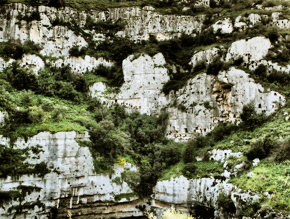
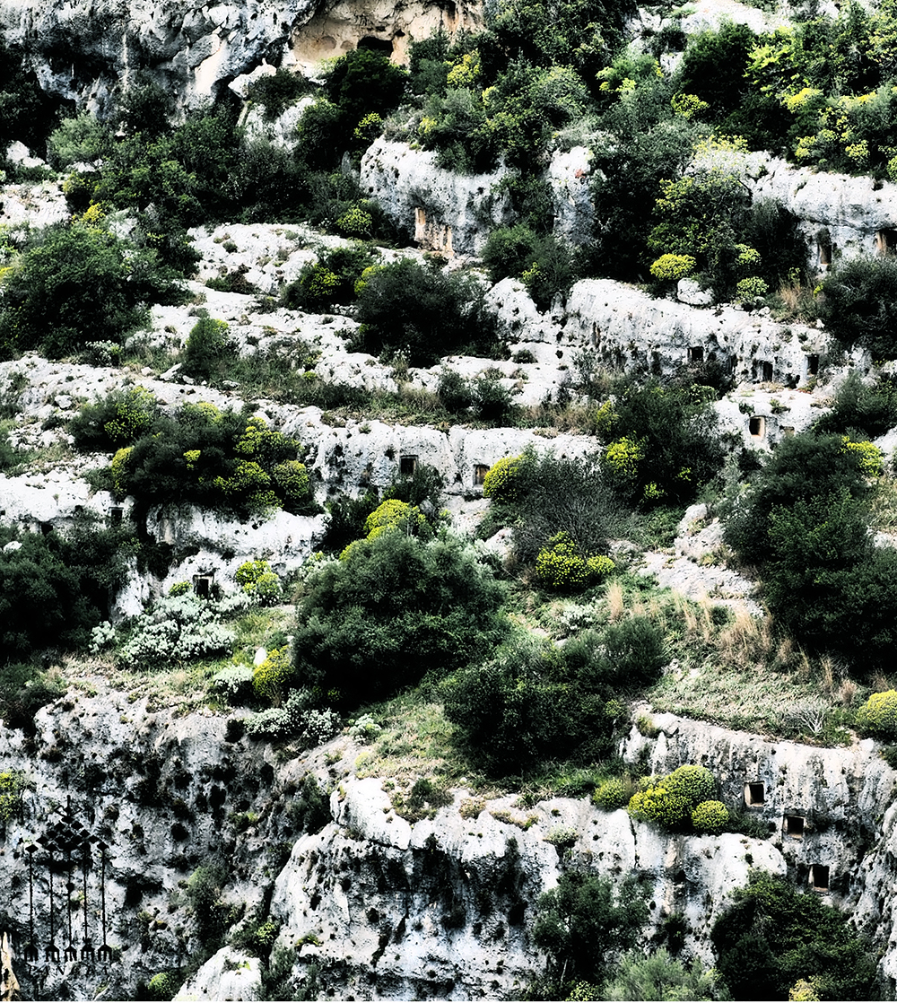
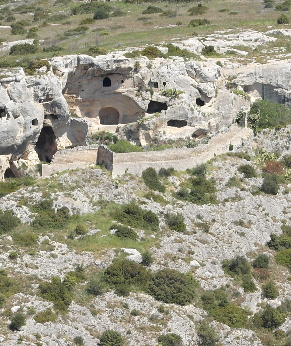
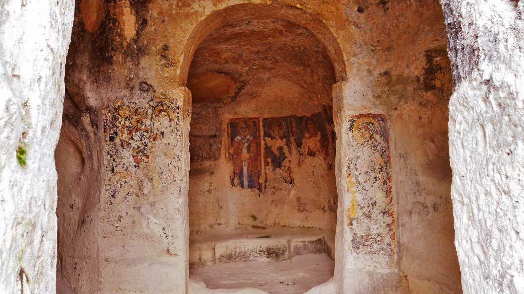
The Bronze Age site of Pantalica in Sicily, situated along the gorges of the Hyblaean mountains, locally called caves, is made up of about 5,000 hypogeal cavities carved out of the slope
The rocky tombs were excavated from the ridge along the slope.
In the Iblea region of Sicily, the site of Pantalica was abandoned during the Classical Era and not undergoing the next overlap, is a valid example of architecture of that period.
On the plateau of Pantalica, the cyclopatic masonry of the palace of Prince Shepherd Anaktoron, dating back to the Bronze Age, is still visible.
The complex has about five thousand tombs excavated in the rocky walls of the canyon of which.
The most archaic ones were small grottoes with circular single chamber and passage entrances.
Subsequently caves appeared with shapes of false domes similar to Greek Tholos.
The tombs with different square rooms with shared entrance and disengagement are of recent times.
The artifacts dating from the XIII to X century BC are shaped according to the local tradition with strong references to mycenaean and aegean architecture.
Pantalica
The ancient centers of the Iblea region in Sicily. Above, necropolis of Pantalica Belowe, Modica arranged in concentric circles along the slope. The similarities with the Sassi of Matera and the ecosystems of the gravine are evident because of their common origin in the hydro-agricultural layout
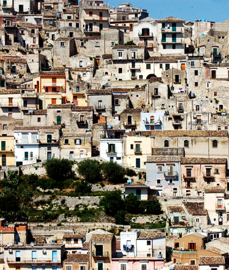
It is significant that in the same region the historical centers of Ragusa Ibla, Scicli and Modica developed according to the water matrix such as Pantalica, exhibit strong morphological analogies with the system of the habitat of the Sassi of Matera and the apulian gravine.
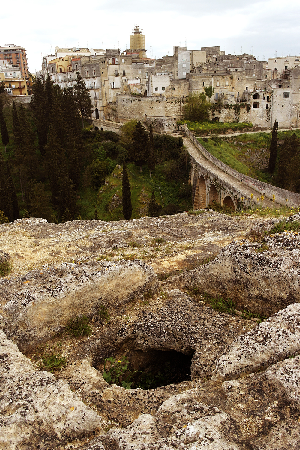
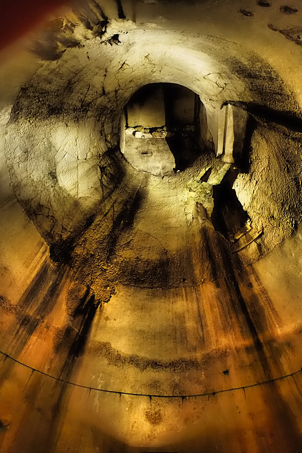
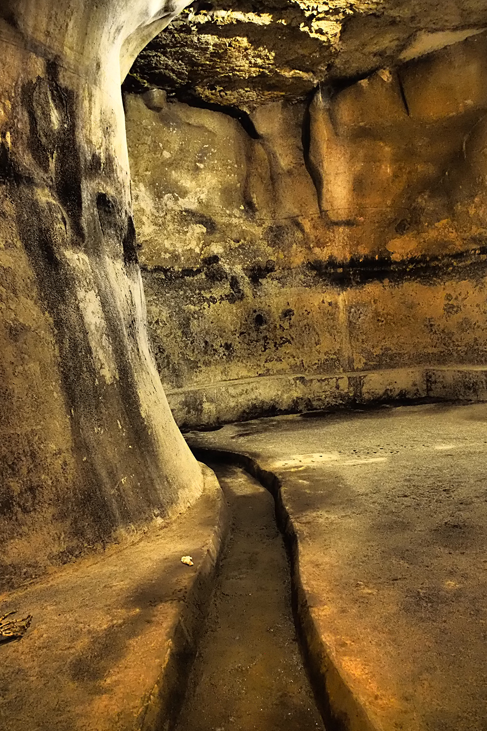
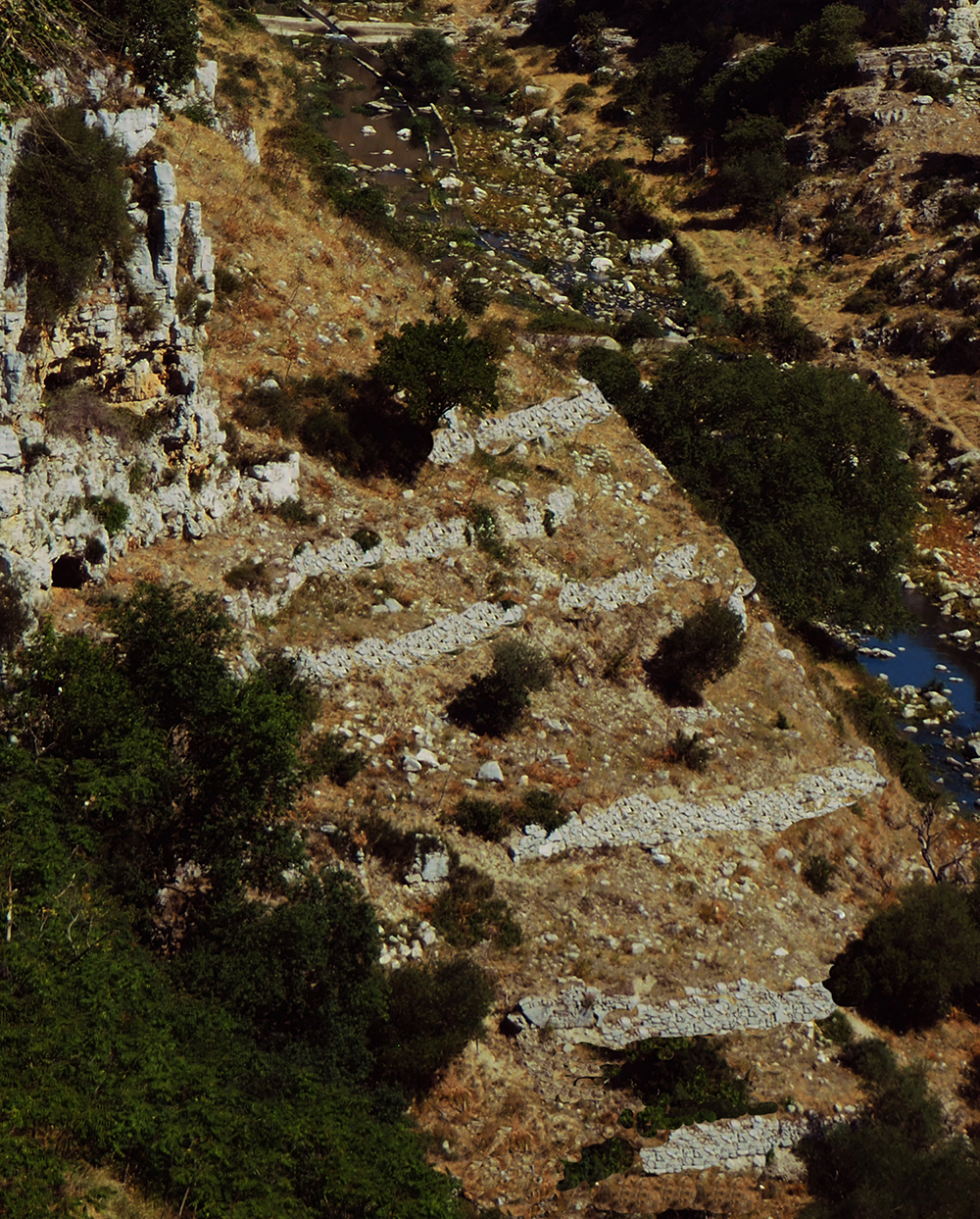
Gravina in Apulia, tombs, water cisterns and hydraulic systems at the bottom of the hill of Botromagno. The aqueduct-bridge still connects both the edges of the canyon to the each other
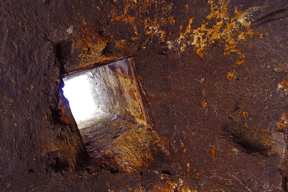
At Gravina in Apulia, the edge of the Botromagno canyon, the great Bothros (Sacred Well or Gorge in Greece), shows the evidence of ancient water used for ritual functions.
Prehistoric engravings and graffiti follow the hollow hole notes with mysterious holes that have been documented by the Sahara in Malta, Greece and the Yucatan at a corner of the stone wall in the Maya Temple of Uxmal.
The holes are water puddles that were probably used for luster purposes and would certainly be filled with rainwater collected in wells dug on the cattle plain.
The holes were used for bidding and depositing, or, it could be used for excavation activities that, like Petra, were made from top to bottom with gangways hanging on strings fixed in the holes.
The foundations of the many monumental complexes excavated in similar limestones in Pantalica’s Anaktoron are very obvious.
In the Age of Metals, every great family clan would have had its place for ceremonies and representations on the edge of the deep rebellion.
The abode was made up of huts where holes left by piles are still visible in the terrain scattered among the rock houses.
With the passing of time, massive works to prevent landscaping by controlling the flow of water to protect this area from hilly erosion show the formation of large protourbanal social communities.
The slope below was used for housing and agri-pastoral activities through the excavation of cave-shaped cave tanks, extending downwards, the water and garden gardens.
When in the 700 BC The Greek colonizers founded the city of Taranto, the indigenous peoples of the city of Gravina, probably unleashed by that foreign presence, made massive works for the preservation of soils and for the collection and distribution of valuable water resources.
On the hill of Botromagno, beyond the mass construction and pipelines that are the result of hard work, there was an efficient agricultural community that built hilly terraces that are still in use today.
During Greek civilization the area on the edge of the gravina was used as a place of worship where a large necropolis settled with monumental tombs of hypogeum.
Water again became the most important element: a recent excavation has brought to light a votive environment excavated in the rock that forms spaces similar to small sacred islands separated by canals where the drainage waters, a Time, they slid down.
In the area, a long drainage tunnel, similar to the Sahara reservoir, reaches a cave that was converted into a church in the Middle Ages.
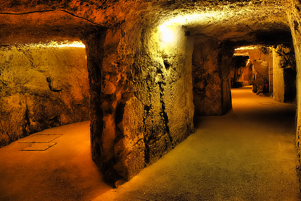
The works of the hydraulic works at Gravina di Puglia have continued in recent times as well, channels and wells extend the tunnel to the edge of the gravina and arrive at the magnificent aqueduct built in the eighteenth century which feeds the city, located on the opposite side of the canyon .
Siracusa (Sicily) Underground cistern
Siracusa (Sicily) Underground city
Siracusa (Sicily) Underground channels
Siracusa (Sicily) Underground city
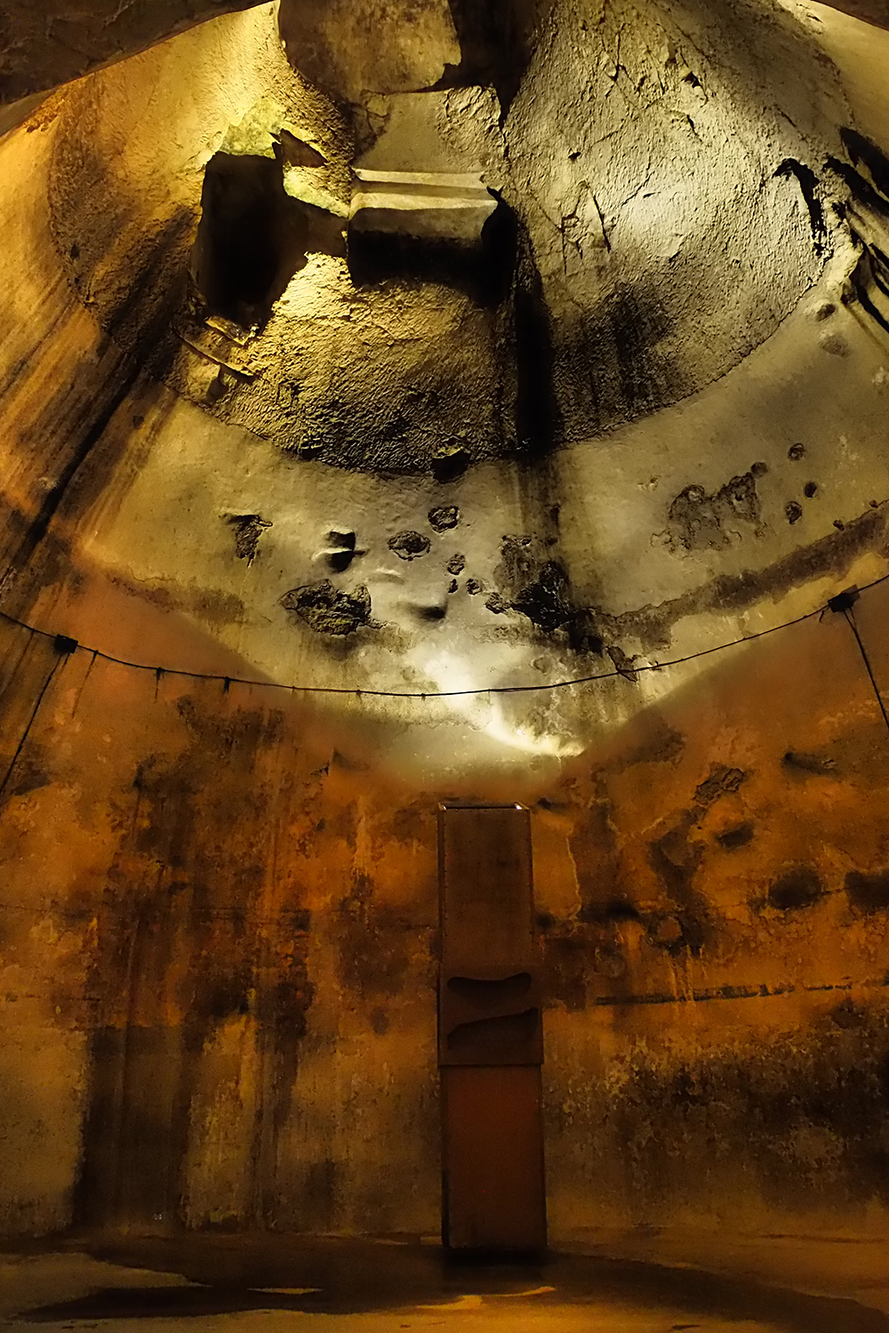
Siracusa (Sicily) Big underground cistern
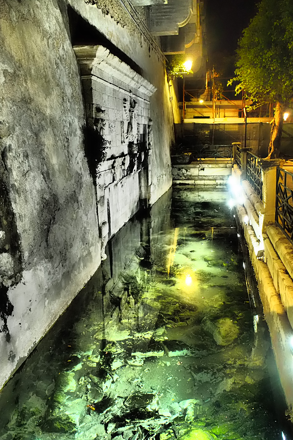
Siracusa (Sicily) Ortigia Island, water pool
In the Classic Age Matera did not have the same importance as Gravina di Puglia.
The current situation of the Sassi of Matera is the result of urban evolution and saturation, of an archaic pastoral structure that has created an urban ecosystem.
The valley lakes on the edge of the gravina turned into common hypogeal courtyards, furnished with imposing basements used for places where collective rites were celebrated.
*
Sasso Barisano , one of the two large depressions forming the ancient town of Matera. The houses, terraces and gardens develop in succesive circles and surround the riverbed of the narrow drainage stream, the “grabiglione”, now paved. The high spur of the Civita, where the Cathedral stands on the rise, overlooks the urban landscape. The dwellings envelop the limestone bed by stretching out into the rock with deep underground cavities whose entrances may be observed where the buildings become fewer and leave the rock matrix bare. Below, Matera, the Ofra Valley. The excavation and the closure of the apertures by means of the tufa wall and the construction of a barrel-vaulted structure, called lamione, are the different types of construction which can be observed
*
The hydro-agricultural origin is important to understand the urban layout of the Sassi of Matera. The Sasso Barisano is a basin into which water coming down from the plain above conveyed. Below, an overhanging garden resulting from the threshing-floors, the agropastoral matrix on which the process of urbanisation was implanted
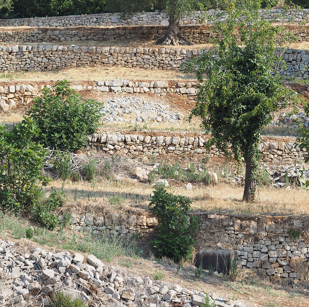
Massive dry stone walls protect from the effests of the rainfalls and create the space for cultivations organised on artificial terraces along the slopes of the Palomba of Matera
In the Sasso Barisano the steps on the slope below the church of S. Agostino witness the terrain matrix, artificially made with supporting walls
*
The Sassi of Matera. Hypogeal barn and transformation of a cavity into a rocky church. The agropastoral devices such as the silos and the cisterns are previous to the process of urban densification during which they lost their original practical function and were turned into cave-dwellings or places of worship
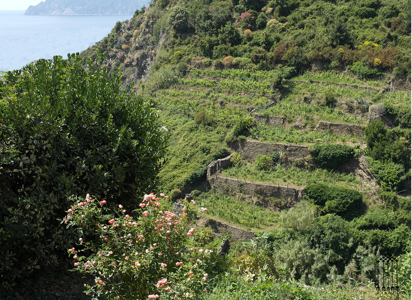
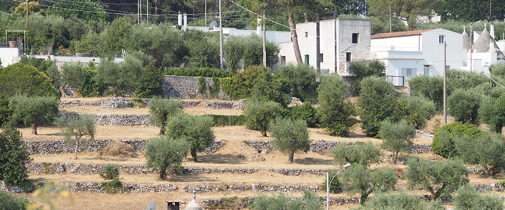
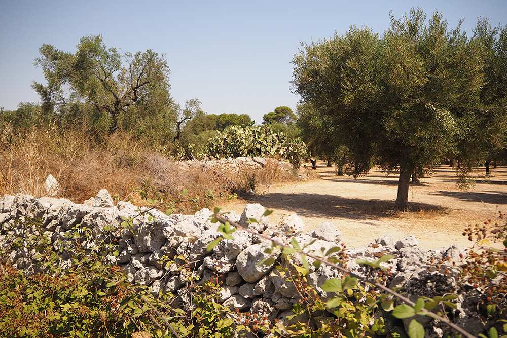
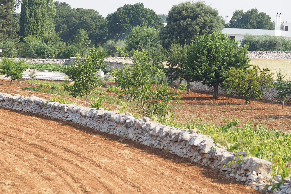
Terraced glacises of the Apulian Murgia highlands on the Adriatic side organised by means of dry stone walls
The process of organizing space in the Mediterranean has been achieved thanks to the exploitation of the slopes and the practice of the techniques for the fertilization of those areas not accessible to previous colonizers.
The plow, used since the beginning of the first millennium BC in the Near East, spread to Europe at the end of the millennium.
The use of metallic tools has resulted in a more aggressive approach to the environment, causing the phenomenon of deforestation and the productive exploitation of marginal areas.
In the same period, the three-point rotation system was introduced: cereals, oats and legumes.
From that moment on, agriculture in temperate Europe has sustained population and urbanization comparable to the hot and sunny areas of the Middle East, based on irrigation.
In the following periods, there were no other important inventions, only the development of more sophisticated systems related to existing techniques and knowledge.
The vineyard and olive grove cultivated on terraced systems, drainage systems, canals, irrigation and reclamation methods, have enabled the use of plains for agricultural purposes.
The practice of pasture land and soil fertilization made agriculture more productive.
The organization of land in the Roman Age, has not damaged the layout of the landscape.
In fact, the imposing Roman hydraulic works have not changed farmland based on the wide variety of technical solutions and widely used, on a small scale, by local communities.
Roman civilization can not therefore be defined as a hydraulic society based on the magnificence of works and on state despotism since the physical nature of the Mediterranean territory formed by inaccessible places, small country plots without large river basins.
The complex organization of cultivated fields and buildings, ritually and spiritually linked, based on the layout and maintenance of the ancient Italian and Mediterranean landscape and its permanence to the present day, was confirmed in the Roman Age.
The Mediterranean is between two climatic systems: the continental and the African continent. This border condition called ecoton makes the Mediterranean climate unique that it’s only in a few situations in the world.
The threshold line is never stable and its fluctuation over time determines the Mediterranean climate.
Although these fluctuations do not have a world-wide influence, they are decisive on a local scale.
It is supposed that the period the greatest expansion of Roman civilization was connected with the northward shift of the optimal Mediterranean climate, while the following periods when the barbarian invasions occurred coincided with the south-south spread of the northern climate.
Up to 300 d.C. the Mediterranean ecoton reached the northern coast of the United Kingdom and spread the Roman model of land use based on cereal production.
After 300 d.C. the ecoton started moving south thus favoring, starting from 500 d. C., the supremacy of the northern populations organized in pastoral economic systems and settlements, that were adapted to a climate that became colder.
At that time the temperatures dropped so much that in 829 d. C. the Nile froze.
Those slight historical fluctuations are now replaced by a process of constant global warming caused by the greenhouse effect that results in the so-called ” Mediterranean tropicalization”.
This condition accentuates the typical features of the area making it extreme. We generally think of the Mediterranean as an environment rich in pleasant places with a mild climate where nature is conducive to.
These are the reasons that make the Mediterranean think of it as one of the first areas in the world with the growth of different cultures and societies.
Instead it is the opposite: the Mediterranean has three parts touching islands and peninsulas free of earth and surface water; its orography is impenetrable and irregular and even in the north the seasons alternate with irregular and catastrophic climatic conditions.
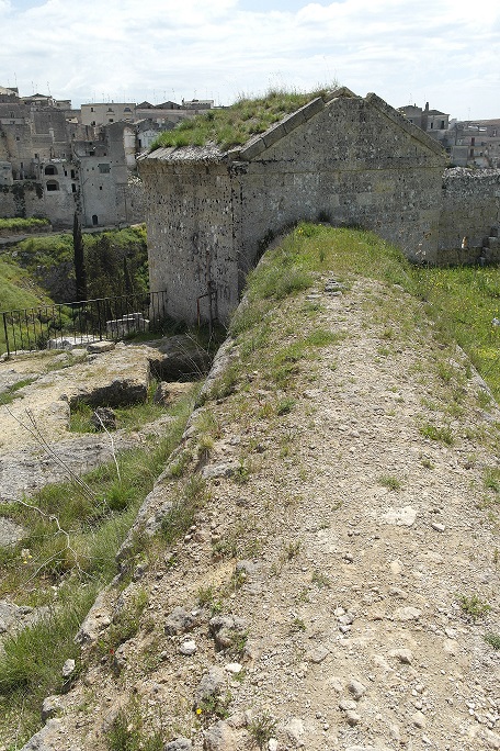
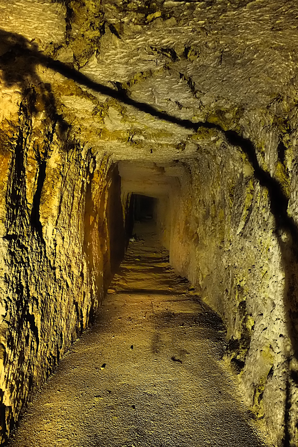
Gravina in Puglia. The underground tunnel of the water system, very similar to the Saharan drainage tunnels, supplies the fountains in the historical centre of the town, situated on the opposite side of the canyon, by means of the aqueduct-bridge which is, in its turn, supplied with water tapped on the hill of Botromagno
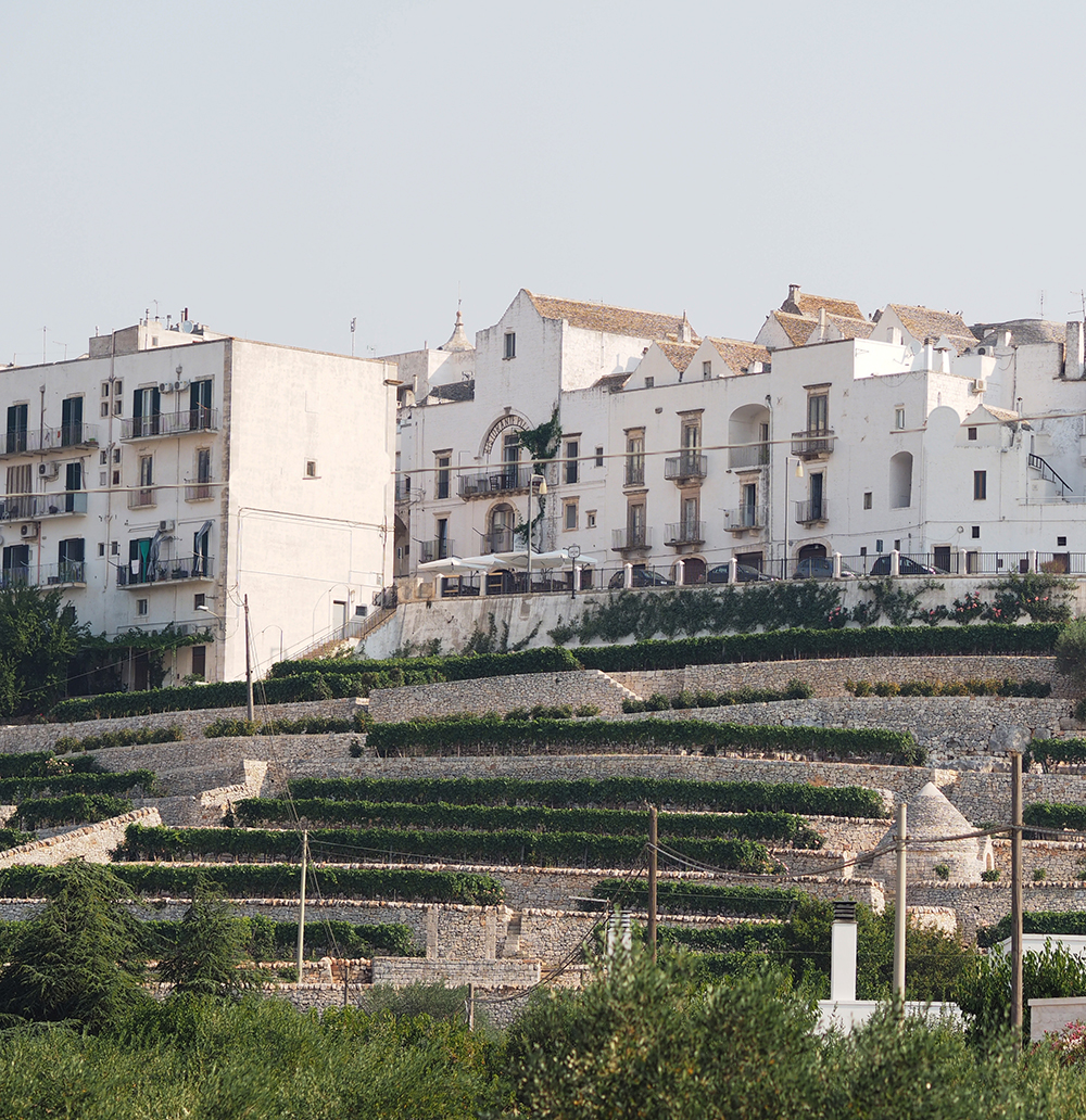
Locorotondo (Apulia) The terraces under the town
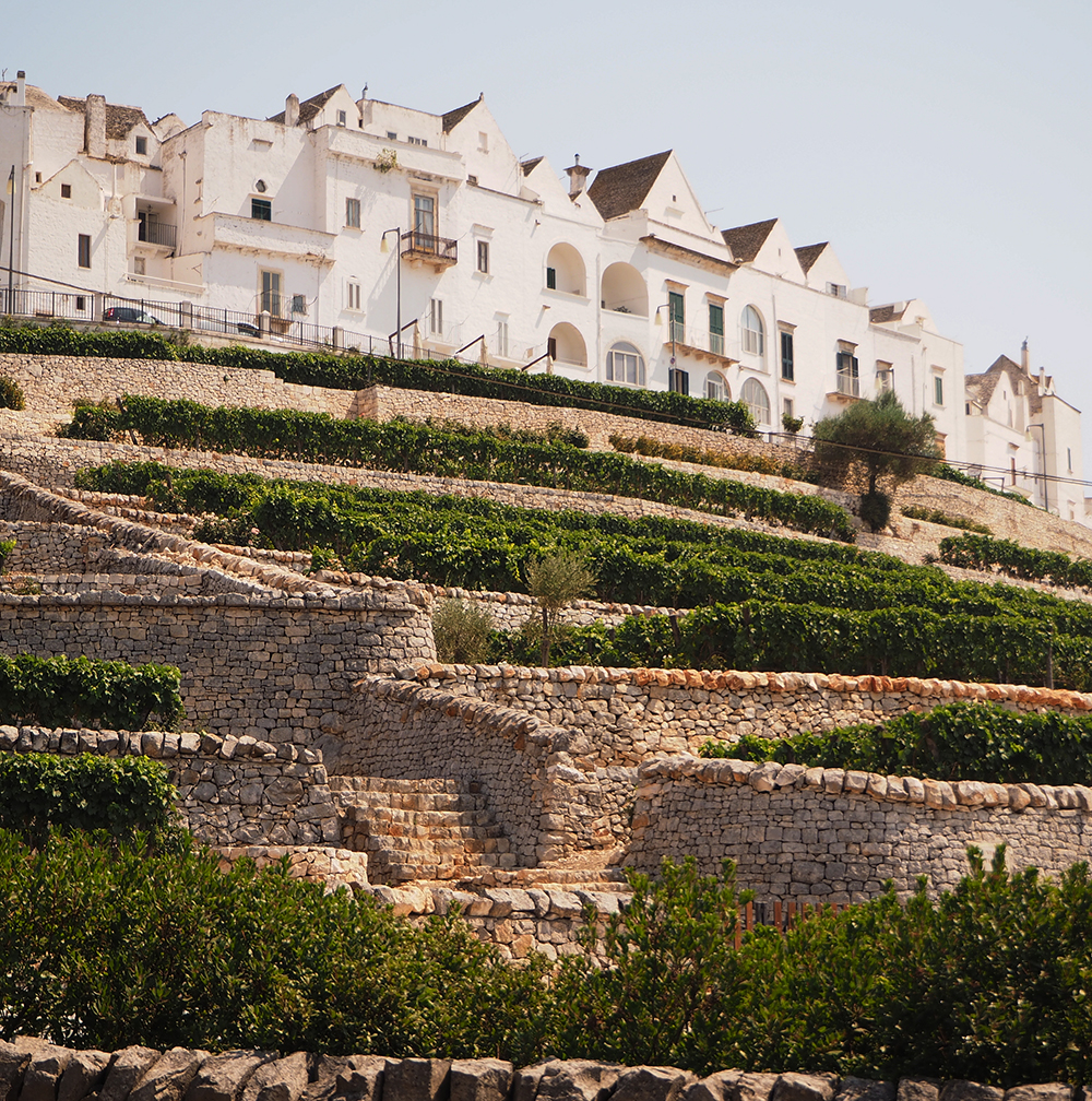
Locorotondo (Apulia) The terraces cultivated with vines
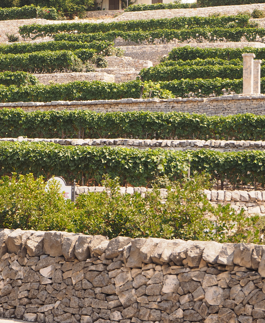
Locorotondo (Apulia) Detail of stone terraces cultivated with vines
The traditional Mediterranean knowledge system is capable of modeling and characterizing the territory over time, developing and treating geographic conditions.
Mediterranean coasts, islands and peninsulas are all hostile and inaccessible areas where culture has developed as a result of difficult living conditions.
In these scattered areas where communications were impossible, human communities could not meet in large systems or form empires similar to those born in continental lands or in large river basins.
The Mediterranean coastline and the hinterland are not fed by large perennial rivers and the water suddenly arrives causing catastrophes.
The flow can be infrequent and poor in some periods and violent and ruinous in others. Therefore, small communities are organized with the management and protection of space on the oasis model based on control and collection of low levels of humidity.
Cretan buildings, Apulian trulli, Palestinian crops, stone towns of the gravine, Tunisian neighborhoods built around wells, fences and ditches in Attica and Boezia, underground settlements in Anatolia, large complexes in Malta, Jordan , Spain and Algeria are examples of oases.
The latter are systems for the collection of precious rainwater and for its best use in case of excess or deficiency, avoiding the destruction of slopes and soil.
Rainwater can be saved and distributed and these simple structures are sculpted so as to camouflage in the landscape.
The organization of space in the Mediterranean is the result of constant work with the aim of preserving the soil and for the proper use of resources by avoiding the phenomenon of erosion and desertification.
Civilization arises from a continual struggle against a nature that has put the populations undergoing various types of cataclysm, such as earthquakes, floods and droughts, migrations and diaspora, fighting and wars.
Despite this, the populations could hand down their culture while maintaining traditions.
Nomads, transuming, disenchanted, and landowners have saved ancient memory by imprinting them on transportable goods: in their handicrafts, carpets, gestures, and songs.
They have preserved ancient memory in places chosen by myth, epics and poetry, and have crystallized them into mausoleums, rural buildings, names given to mountain ridges, and stories that permeate in the valleys of the rivers.
Communities have established a set of rules, costumes, ways of acting and living through this cultural process that emphasizes their identity, took possession of places by molding the landscape.
Landscape building and maintenance are closely connected with a process of knowledge and identification: everything that is perceived as being is safeguarded.
At present, the main risks for populations derive from the loss of this equilibrium which involves the lack of reference points.
Knowledge, essential to make space suitable for human life, is ignored.
Migrations and the agricultural crisis have deteriorated the ancient structures so that their original function of maintaining the territory is difficult to recognize.
The Mediterranean environment brings the signs of destruction and degradation caused by natural phenomena or a bad interaction between humans and space.
Gravina of Laterza – Hanging gardens arranged in the riverbed of the gravina
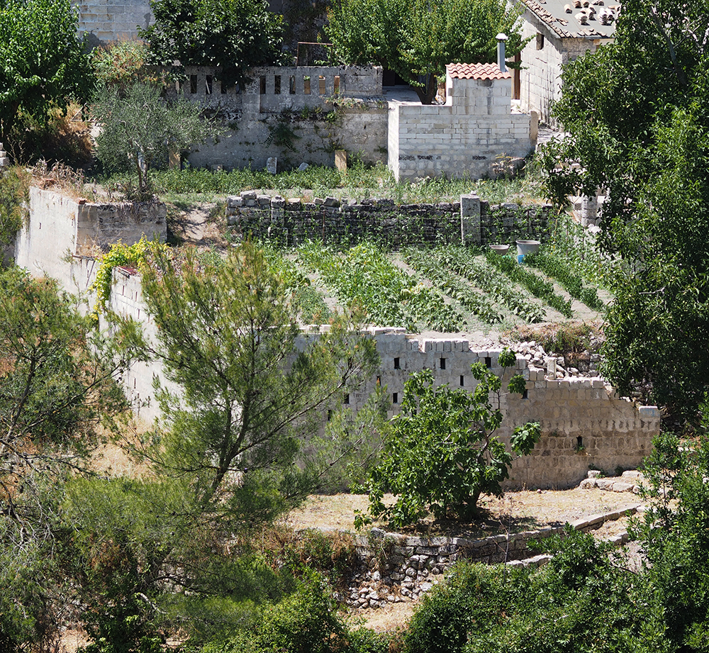
Gravina of Laterza – Hanging gardens arranged in the riverbed of the gravina. The bed of the torrent goes below the cultivated terraces crossed by small bridges with arcades
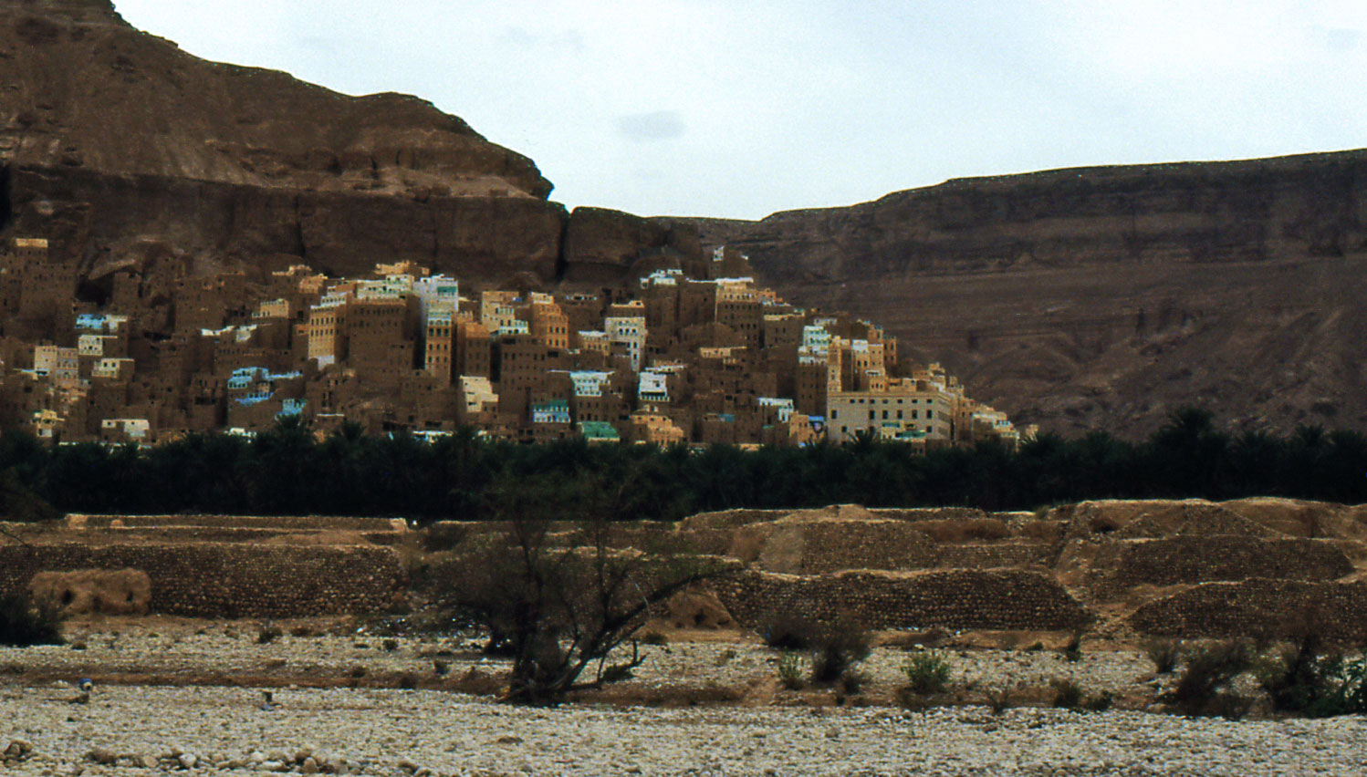
Hadramaut (Yemen) In the raw earth towns of the Hadramaut Valley are still practiced the ancient hydraulic and agricultural techniques nabatean and sabea
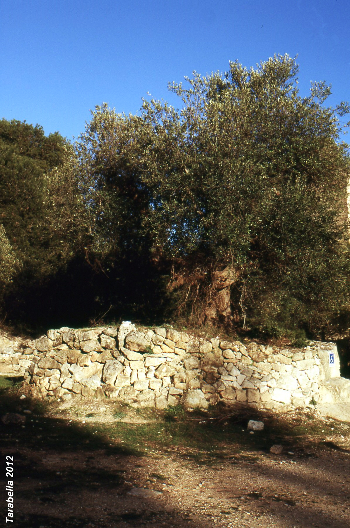
Olive tree moistened by a dry stone wall similar to the Nabatean teleylat in the quarry of Fantiano in Grottaglie (Apulia)
The tradition, the knowledge that formed within this process, emerges periodically in the great deposit of popular wisdom: THE LANDSCAPE.
In the Mediterranean there are many traditional techniques related to water collection and management, storage and channeling in addition to slope protection systems and soil productivity.
The first were introduced by sailors who built water tanks, known only to them, in the tanks of the islands along the arid shores that were then spread by nomadic tutors of organizational knowledge of the landscape.
Structures such as underground tunnels for water have also been found in the most important North African and Eastern oases.
To the south of Italy, in the Mont d’or near Lyon in France and Spain, the origins are ancient and introduced by Islamic civilization.
The various techniques of water conservation typical of Nabatean agriculture, caves and condensation wells. stones rocks for rainwater collection and underground dams, are found in the Negev and across the Mediterranean.
These techniques developed in an urban ecosystem of the Petra town in Jordan but exist in Tunisia, Libya, southern Italy and particularly in the islands and have been transmitted from the ancient prehistoric tradition or introduced with the latest streams of communication.
Andalusian agricultural techniques in Spain are related to Islamic civilization.
The particular and ingenious irrigation practice called “feixe” persists in the island of Ibiza.
Feixes is a cultivation system based on the division of fields into long and narrow rectangular particles separated by a network of channels.
These channels drain excess water, ensuring collection and water saving, allowing irrigation of the fields in drought periods.
Without this space organization, the area would be marshy in some seasons and arid or flooded by seawater in others.
The technique has the ability to self-regulate which allows to intensively cultivate both swampy and arid environments.
The open air channels are about a meter deep and flow to a lower level than the soils so they keep dry.
The excavation site of the canals is used to increase the level of the ground worked.
In warm times, when there is a high evaporation of the soil, the amount of moisture is absorbed into the osmosis substrate and by capillary action directly from the sides of the channels.
This process is supported by additional underground channels excavated inside the plots.
Subterranean channels are made of porous stones and pine branches covered with a layer of Posidonia seaweed collected on the coast.
The method ensures the operation of the water supply pipes and sufficient soil permeability that releases the right amount of water.
The roots of the plants are thus, irrigated directly in the subsoil.
This technique saves water that could evaporate by using open water irrigation methods.
Ibiza (Spain) Typical feixes landscape with characteristic portals that mark the channel crossing point before entering the fields
A similar procedure was adopted by the Atzechi in the Mexican floating gardens called “chinampa”, where the fields are arranged on rafts in freshwater lakes.
Traditional techniques are adopted not only on the coasts of the southern Mediterranean and in the regions of southern Europe but also in northern France and even in the Swiss mountains, where certain geomorphological conditions cause aridity.
The phenomenon of deserts at the foot of the hills in Switzerland creates conditions of dryness in the valleys.
In the Valais region and in the province of Sion, there are green pastures and numerous vineyards.
Landscape is not the result of natural conditions, but rather of a skillful use of traditional local technique called “bisse”.
This is made up of a series of wooden or rock-drilled canals that run for many miles in the mountains to the springs of perennial streams and glaciers.
They extend very gently along the steep edges, staying high altitude and carrying the water along the natural course of the river bed using only the gravity force to irrigate the far distant valleys.
Just like in northern Africa and Spain, this system generates a particular landscape where the location of the settlements is determined by the layout and the exits of the bisse.
Alberobello (Apulia)
Alberobello (Apulia) Detail of the agricultural terraced system
The most popular system, which can be described as one of the main characteristics of the Mediterranean area, is the terracing that spreads from the Middle East to Greece to Portugal and Italy.
The terracing associated with olive and viticulture contributes to modeling the landscape.
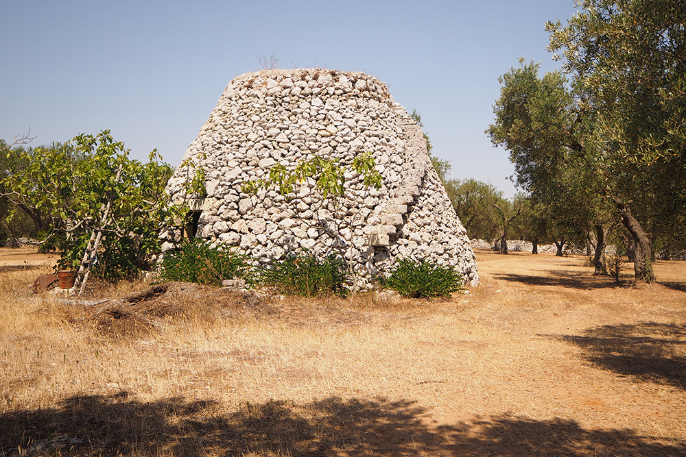
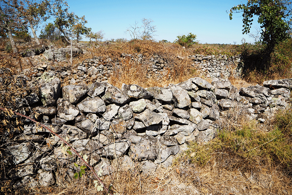
Along with dry stone walls, the tumulus of stones (specchie) and buildings such as trulli and tholos, terracing they are typical of Apulia.
The terraced slopes of Amalfi but also the Cinque Terre of Liguria in the north of Italy, create fascinating and traditional urban ecosystems.
Salento (Apulia) Specchia
Alentejo (Portugal) Terraced fields called tanka
In Sardinia and in the Ibiza island there are systems of fields surrounded by dry stone walls called “tanka”, a term derived from an ancient Mediterranean toponym.
The dry stone walls retain moisture and help replenish the water.
The fact that this technique has spread to northern Europe, Ireland and the Orkney islands, makes it think of a diffusion linked to cultural reasons such as megalithic prehistoric art and pastoral practices.
However, it is necessary to consider that in cold climates, stone walls and columns prevent the water from freezing in the ground.
These structures act as thermoregulators and provide plants with adequate water supply.
In the Burren region of Ireland, in spite of the humid and rainy weather, pastoral needs and karst, have encouraged the spread of tanks and rainwater collection systems.
Some stone fences in the area date back to prehistoric times of dolmen and cromlecks.
Some devices still in use may explain how Apulian specchie work; the heaps of oblong stones, very similar to the specchie, have their peaks covered with plaster for collecting rainwater that is deposited in lateral tanks.
In the absence of rain the stone heaps attract moisture and provide water supply.
The construction of most of the ancient Mediterranean centers follows the structure of the terraces and the network of water systems.
Rainwater harvesting techniques, areas with walled gardens, organic residues for humus production, passive architecture methods, climate control for food preservation, and energy saving have been integrated and perpetuated in the structures of the ancient Mediterranean centers.
Salento (Apulia) Dry stone walls
Alberobello (Apulia) Dry stone walls, typical of southern Italy, which border the crops
Alberobello (Apulia) Dry stone fences
Martinafranca (Apulia) Vineyards surrounded by dry stone walls in the Apulian countryside
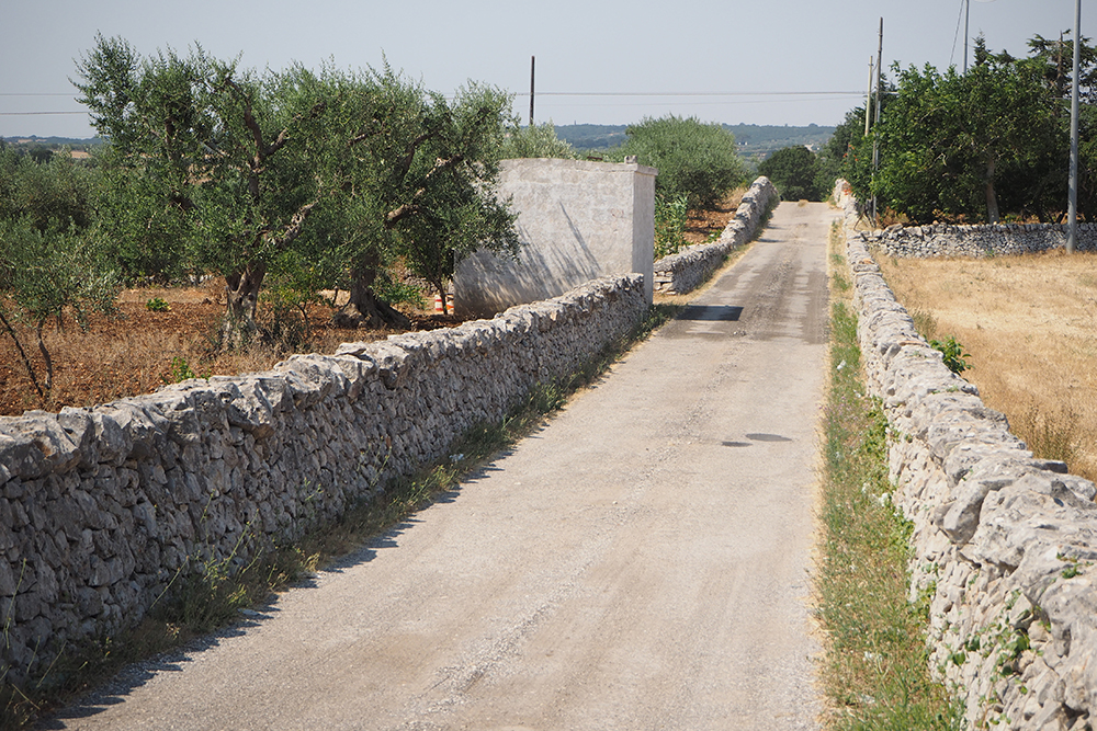
Martinafranca (Apulia) The typical dry walls delimit the streets of the Apulian countryside by designing and characterizing the landscape
The aesthetic components we appreciate in the cities, the beauty of natural materials, the comfort of buildings and spaces, the organicity of the relationship with the landscape, is due to the qualities of traditional techniques and the search for symbiosis and harmony rooted in knowledge local.
Throughout the Mediterranean, the economy of poorly-developed companies, to ensure their survival, has been based on careful and parsimonious management of natural resources.
The close relationship between the ancient, agricultural techniques and settlements makes traditional historic centers become fundamental to the conservation of the environment.
In the whole Mediterranean area, characterized by an intense anthropic process, there is no totally natural environment.
The Mediterranean is a cultural landscape where historical centers are the crystallization of knowledge adapted to proper management and maintenance of the environment.
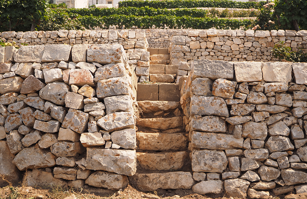
Locorotondo (Apulia) Detail of stone terraces cultivated with vines
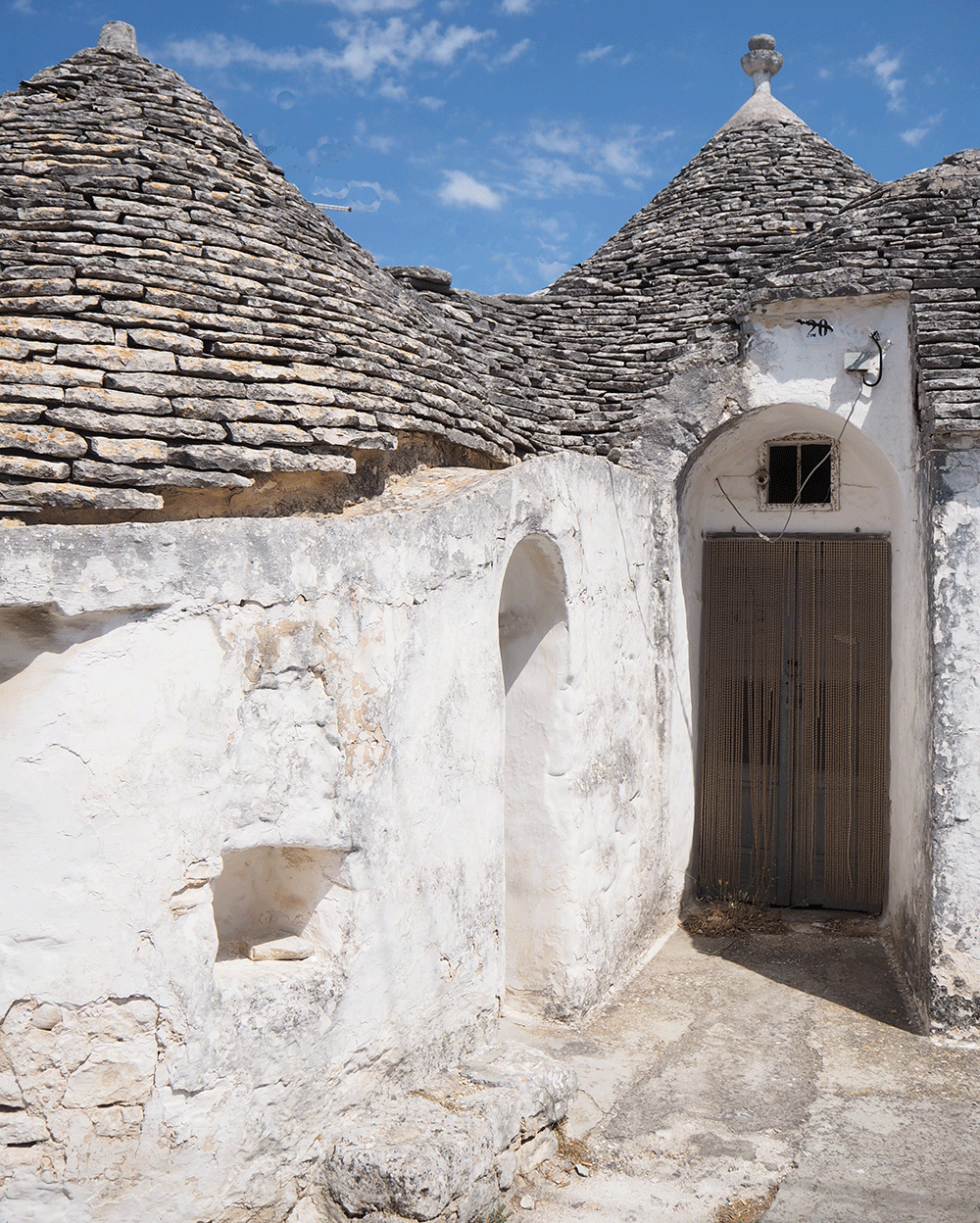
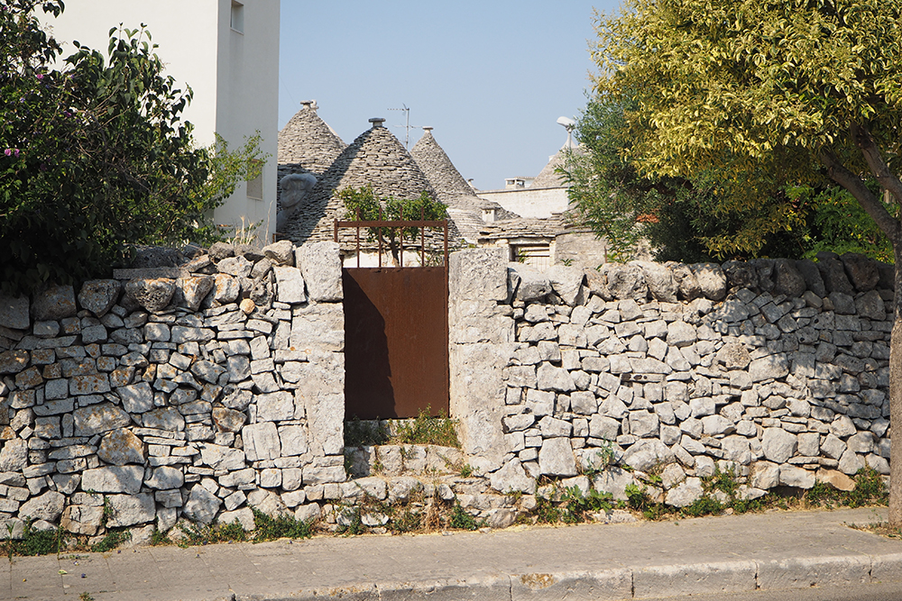
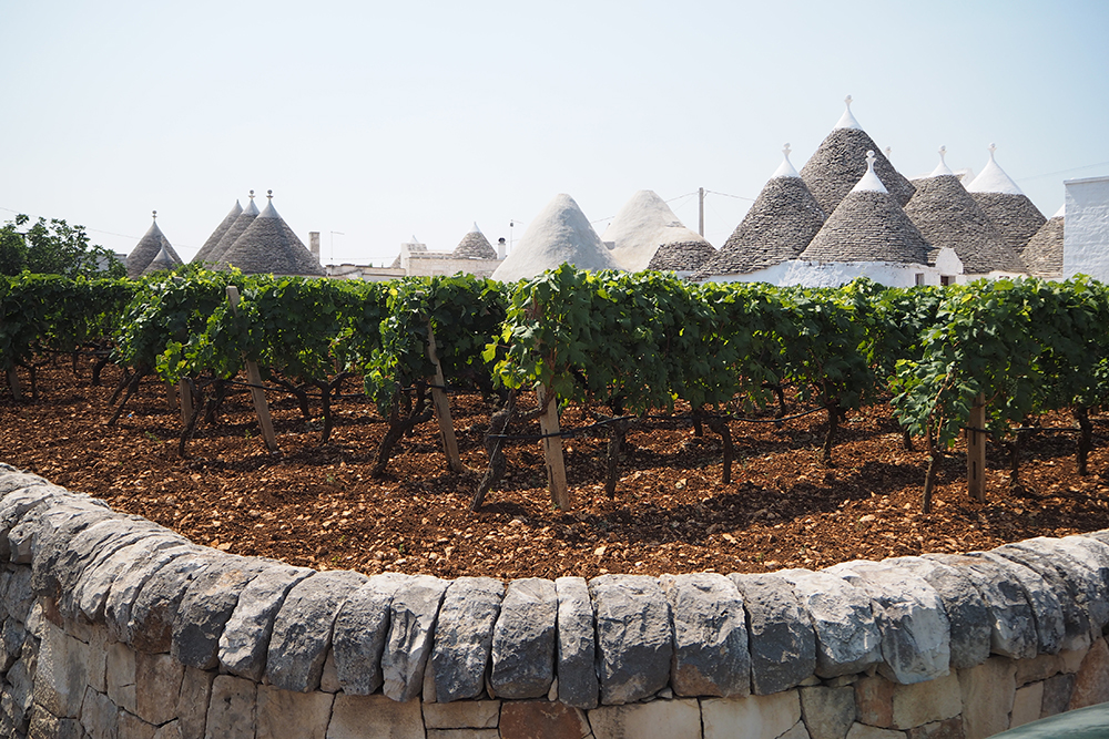
The trulli spread in the region of Apulia draw their origins from the Mycenaean tholos of which some archaeological traces were actually found in the area
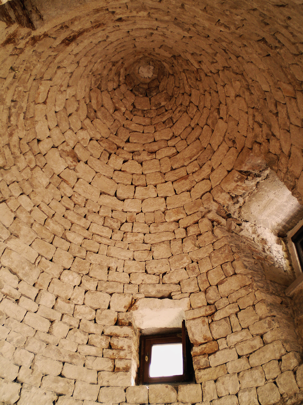
The interior of a trullo. Like the tholos, the covering of the trullo is a false dome which does not need a keystone on the top to support itself
Roofed cistern, a water production device on the Murgie. The slope of the roof emerging from the ground catches water which pours into drinking troughs for the animals. Micro-flows of water from the subsoil collect in the hypogeal chamber
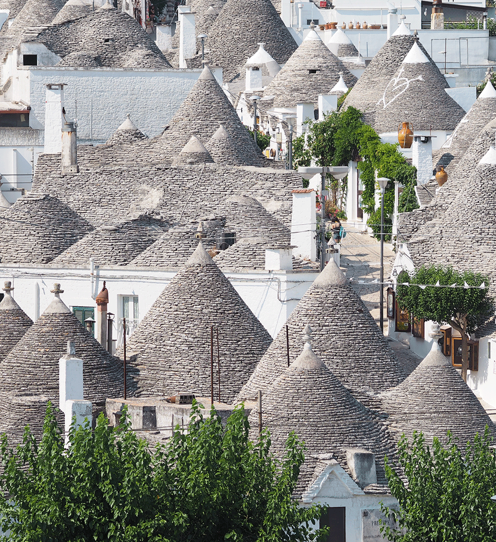
Alberobello (Bari) is the historical centre where the megalithic technique of the trullo evolves into the urban ecosystem